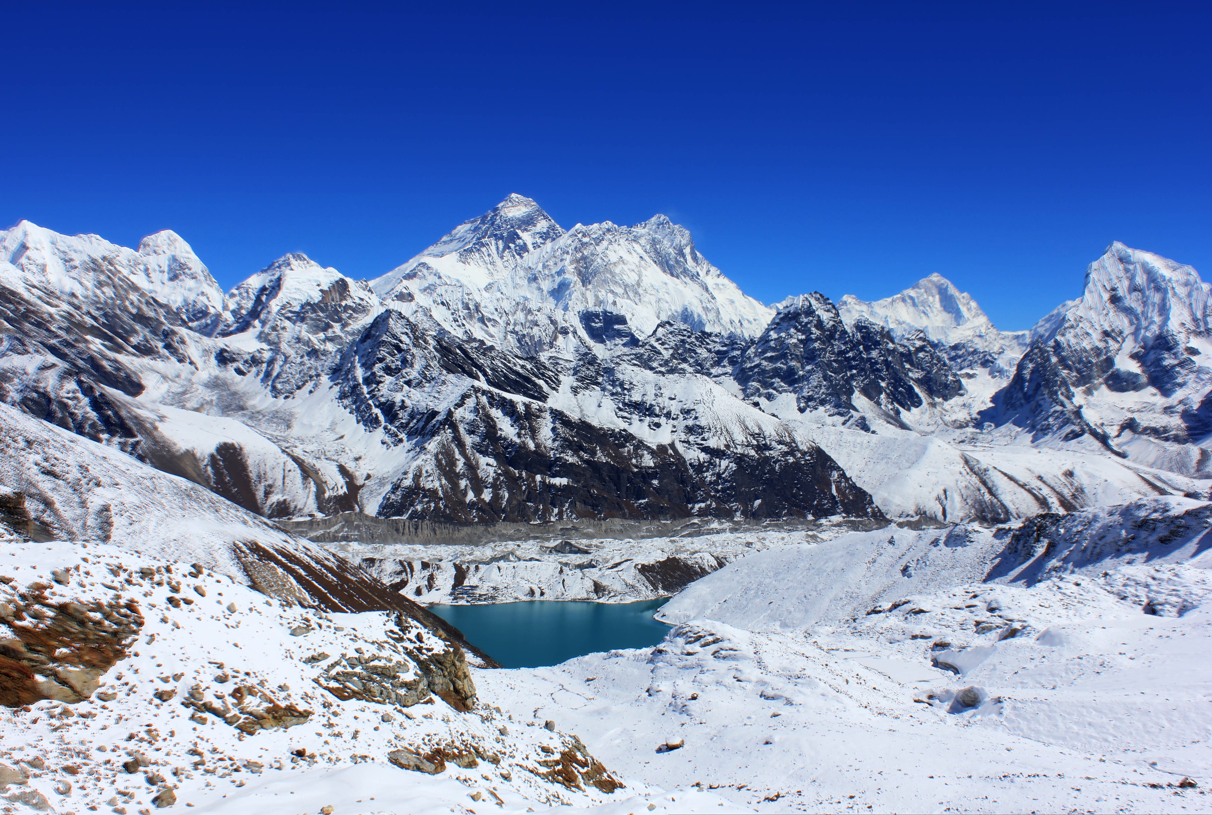
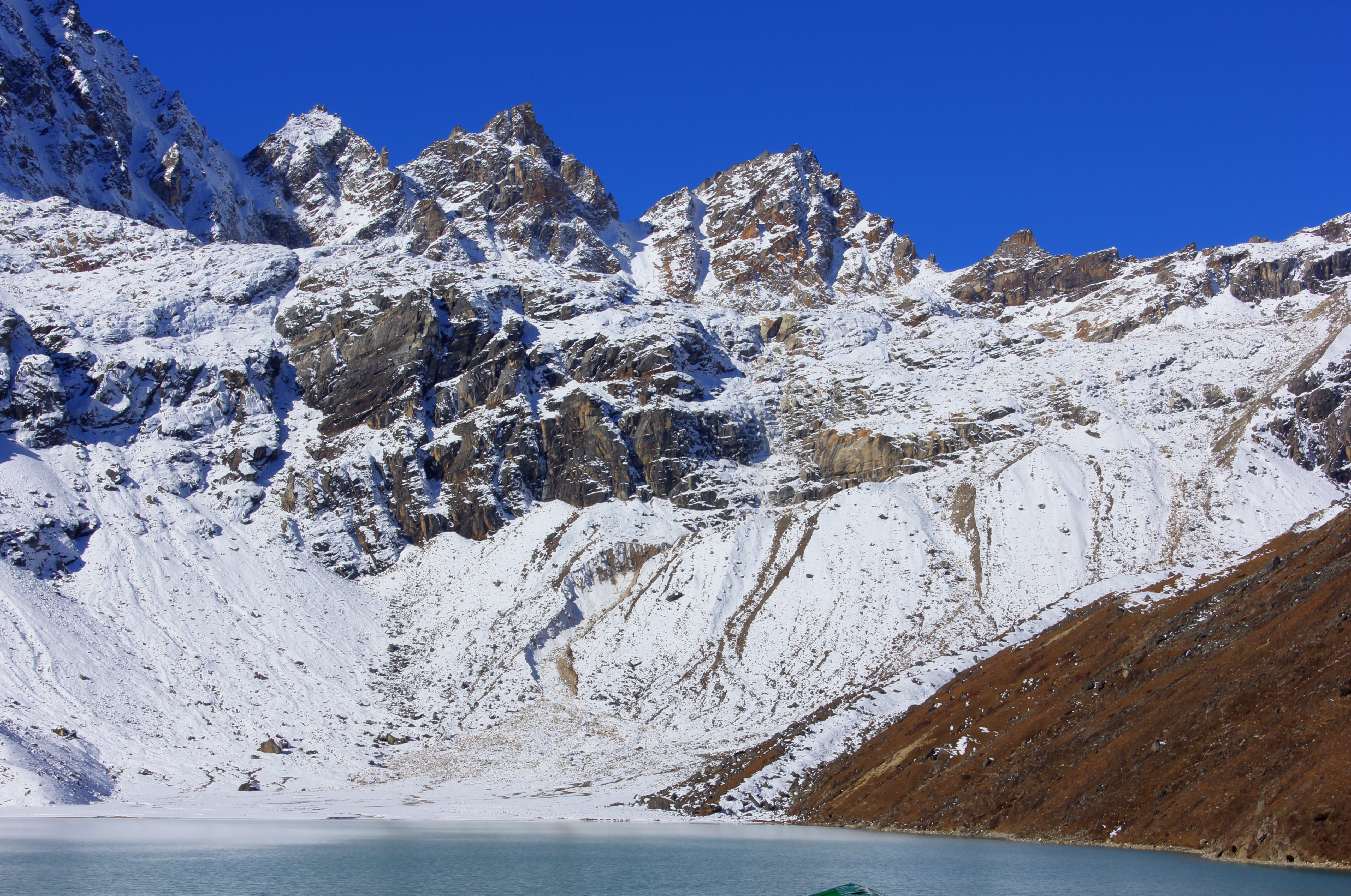
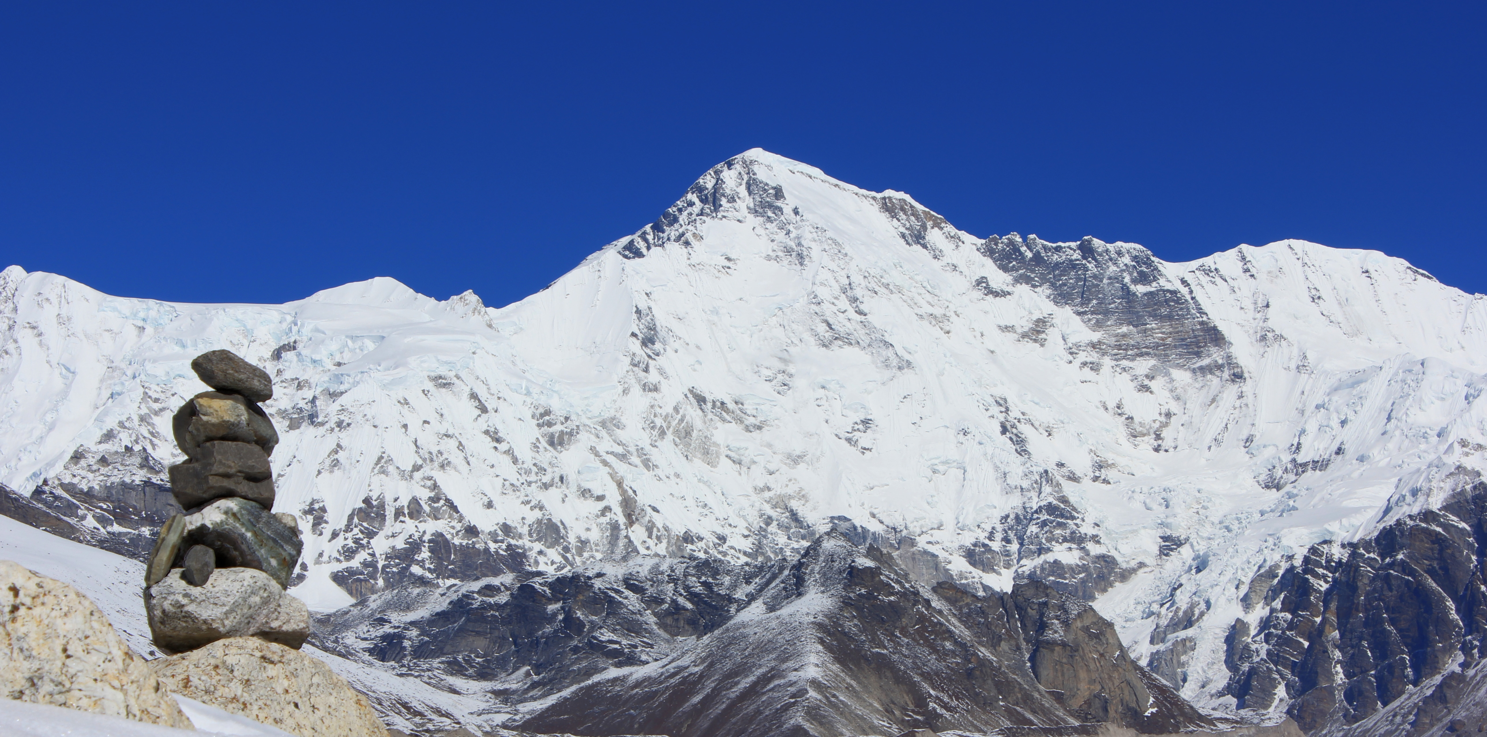
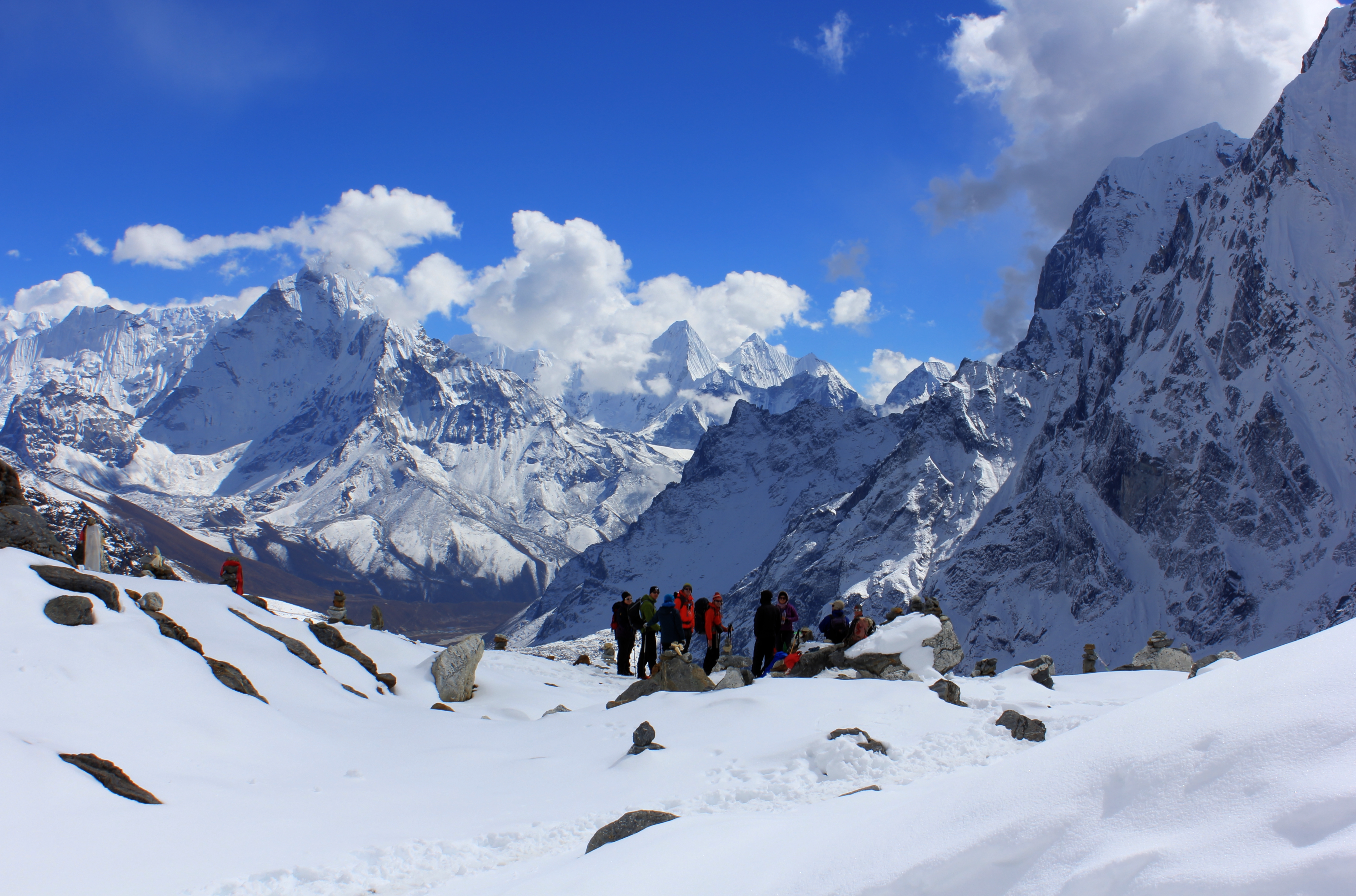
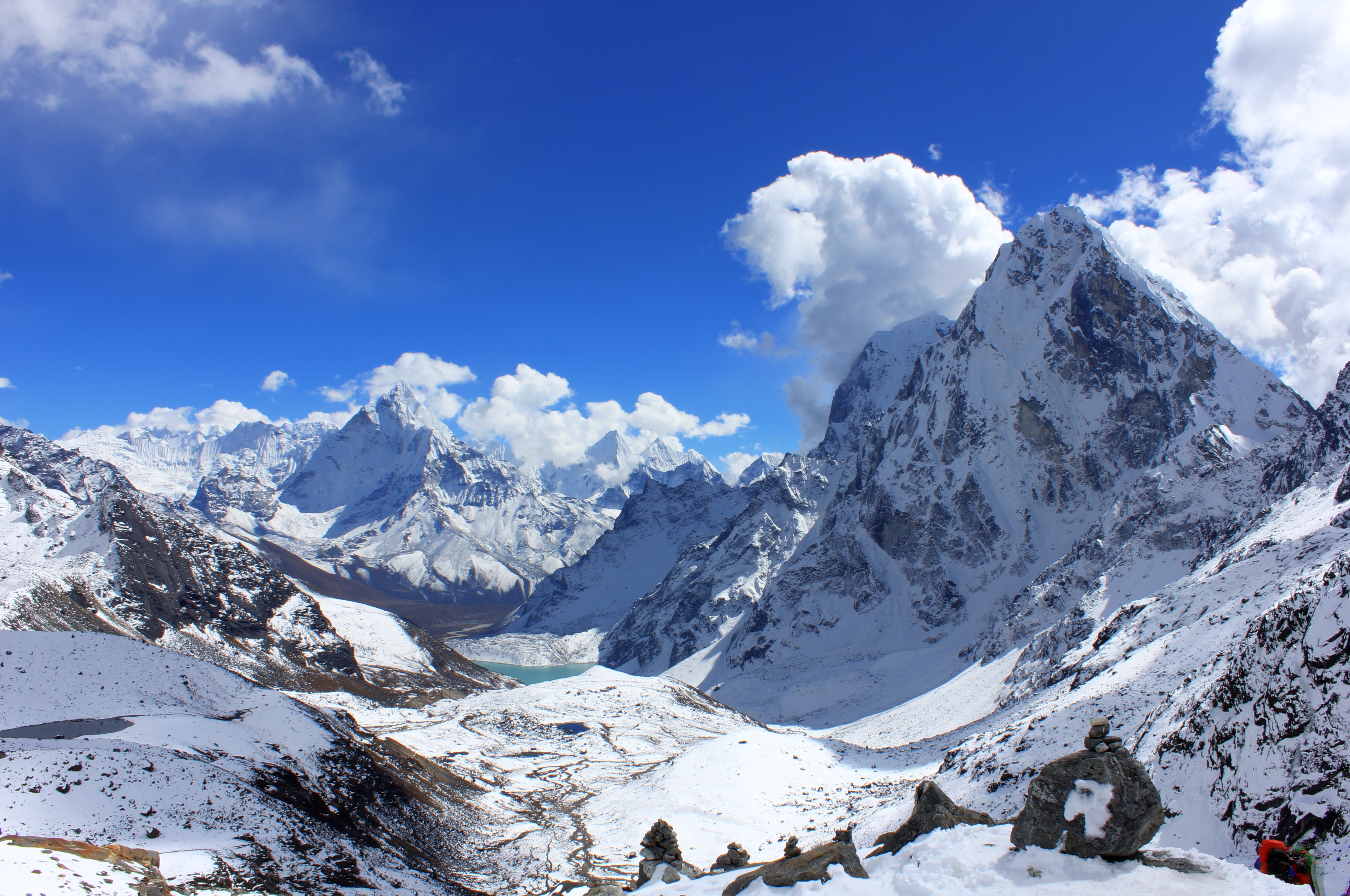
The view to Gokyo from the Renjo La.
Everest is the high peak on the left above the lake.
An account of a Jagged Globe Trek in October 2014, with Nigel and Lisa, Hugh and Richard, Lianne and David, Helen, Colin, Chris, Phil and Alex the trek leader; Dawa the sirdar and Nuru his deputy; Lots of porters, a cook team and a few yaks!
Monday 13th October
This wasn’t my first time to do this, but I still felt the shock as the alarm woke me at 0350hrs in the morning. We were at The Summit Hotel in Kathmandu and our plan was to get an early start to beat the bad weather before it compromised any of the flights into Lukla. The usual scenes of chaos gripped the airport as people weighed, packed and repacked their kit for the Twin Otter flight into what has been dubbed as one of the world’s most dangerous airports.
Dawn had now broken and as we drove onto the tarmac to board our plane, I could see snowy giants forming the horizon outside the city. The flight was as exciting as ever, with a view over the pilot’s shoulder as we tipped toward the landing strip at Lukla. It seemed more like we were going to crash land into a school playground than land at an airport, but land we did with the wheels squealing as we braked sharply and rushed uphill toward the huge stone wall at the top of the landing area. We swung uncomfortably close to another aircraft that still had it’s propellers spinning and we climbed out into the noticeably colder and thinner air of our destination.
Not unusually, some of the bags had been split from us and we needed to wait in town until they arrived. The short walk up to Tara Lodge made my lungs ache and I knew it would take a few days to get used to the thinner air.
By 0930hrs, we were on our way north out of town towards Phakding. At the Tourist Police Post on the edge of town, the police took a record of everyone’s camera and phone brand. I’m not sure what that was going to achieve, but everywhere has it’s little bureaucratic foibles!
Heading north from Lukla to Phakding
The path is well paved this close to Lukla and undulates between lots of Mani Stones, Prayer Flags and Prayer Wheels. As you leave the town, you pass through a “Kani,” which is like a gatehouse with prayer wheels inside it. In order to utilise the prayer wheels properly, you should spin the ones on the right hand side in a clockwise direction.
The hills above us were heavily wooded and there were many terraced areas visible that were being farmed. We stopped early for lunch and I didn’t think the cook team had settled into their routine yet as it took a long time for the food to be served. The wait was worth it though as the food was really good. Nothing too fancy, but lots of soup, and plenty of carbs to keep you going.
Unfortunately, our lunch stop has coincided with our first rain shower, and what started as a gentle picking of rain, soon became fairly persistent and didn’t stop until we reached Phakding. We crossed the river on the first of many suspension bridges we would encounter and our damp campsite was practically at the other end of the bridge at a tea house. By 1400hrs we were getting into our first cuppa of the afternoon and watching the rain wash over the tents outside.
A lazy afternoon allowed us all to catch up lost sleep from the morning’s early start and by 2100hrs we were all heading to bed for the night.
Tuesday 14th October
Bed tea was delivered to the tents at 0600hrs and by 0645hrs we were packed ready to go as we filed back into the tea house for breakfast. 0745hrs was the designated time to set off for the day and matched exactly with the start of the day’s rain.
The first 20 minutes of walking led us along an undulating but always rising path. There were lots of tea houses and even more being built or renovated, with new paths down to their doors. It was a busy route between Lukla and Namche Bazaar, with Phakding being an obvious stopping point along the way.
The weather couldn’t make it’s mind up and it stopped and started raining over and over again. It was warm work walking along in waterproofs and with the humid air and rain, I couldn’t decide whether I was getting damp from the weather or just from my own perspiration. The track follows the Dudh Koshi (river) and crosses it numerous times on suspension bridges, where it’s wide, and smaller wooden or metal bridges where it’s narrower. “Dudh” is Nepali for milk and is an apt description of the river as it foams between huge boulders and pools on its way down the valley.
The path was paved on steeper sections with great stone steps that got steeper as we moved up the valley. We snaked between porters, yaks, horses and other trekkers. Lots of other trekkers! Compared to my last trip to the region, this was a much busier route and I was already looking forward to getting onto the less visited paths above Namche.
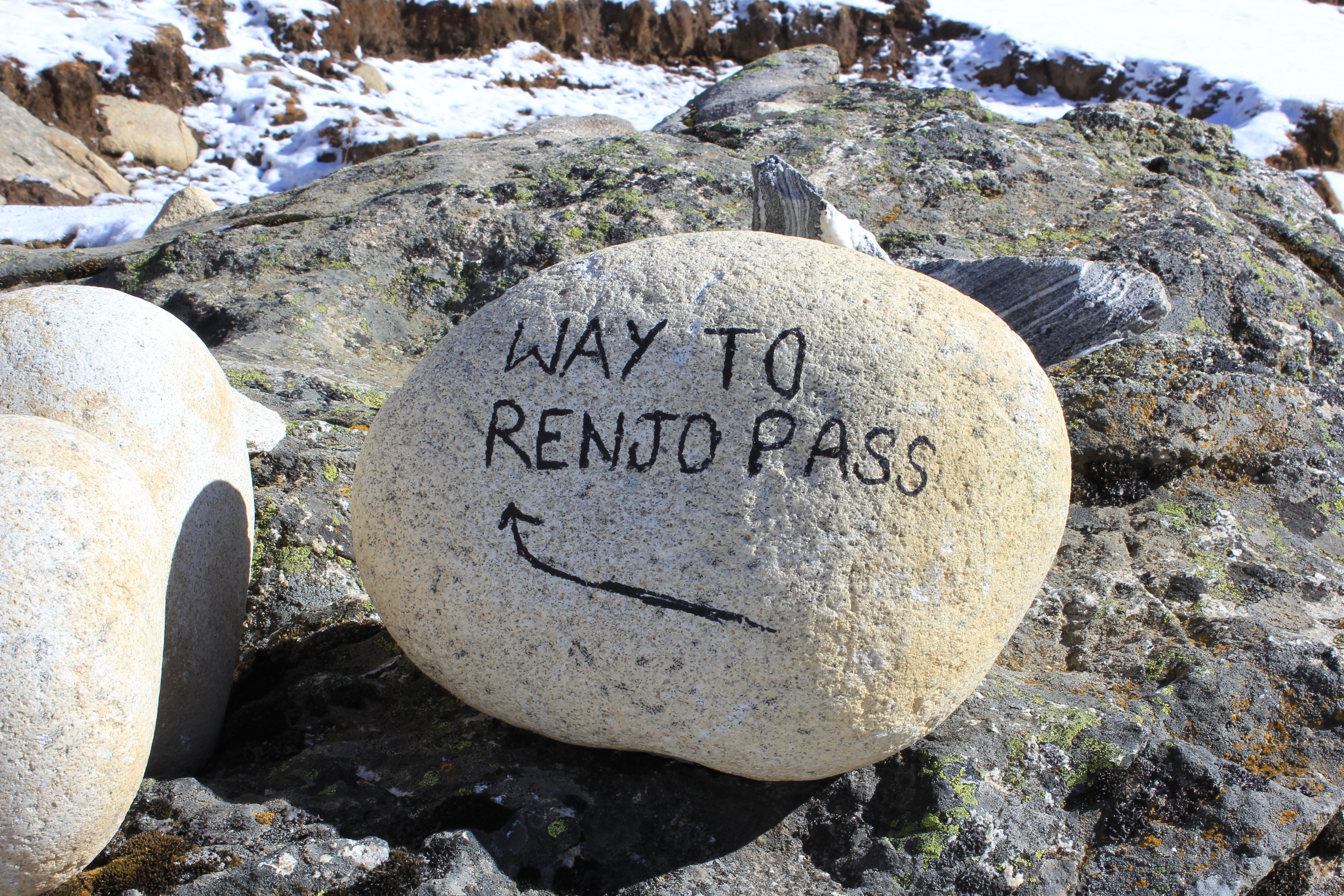
A helpful sign at the side of the trail!
A wet day on the road to Namche Bazaar
Today’s lunch stop was even earlier than yesterday and by 1030hrs we were ushered into a Tea House at Jorsalle. The cook team were still having some issues, again we had a really good meal, but the whole process took 2 hours!
The afternoon’s path continues to cross and re-cross the river until it arrives at the confluence of the Dudh Koshi and Bhote Koshi, with two huge suspension bridges spanning the gorge above us. The lower one is on the older path and can still be used, but the newer upper path is more direct and the best way to go. It’s also a lot higher above the river and gives some spectacular views.
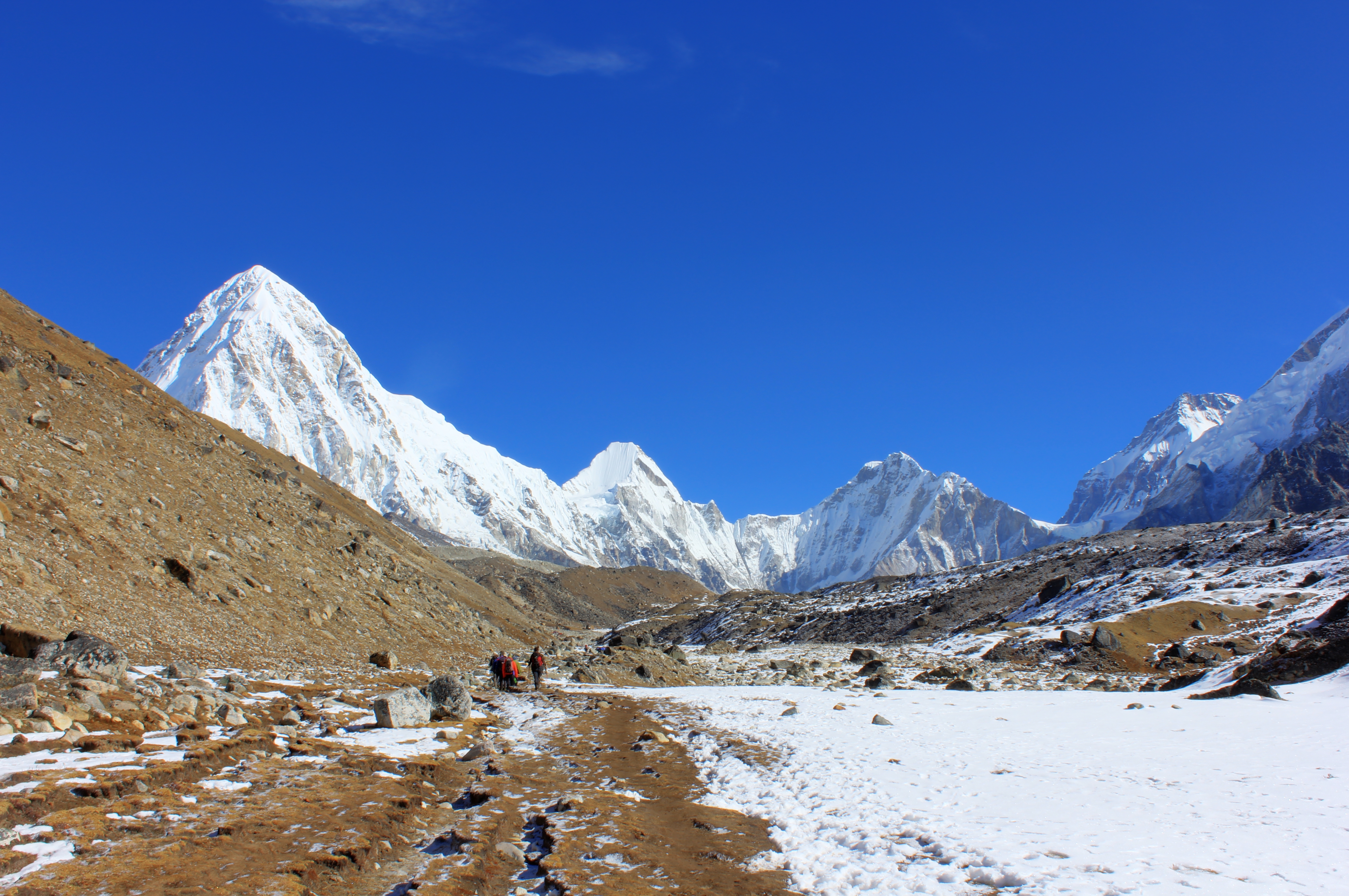
After the bridges, the path doesn’t really undulate any more, it just climbs. And climbs! It’s only up from here. We reached a viewpoint from which we should see Everest, but because of the weather it stayed hidden from view. A little further on again was the Park checkpoint and we waited there for 20 minutes as some more paperwork was sorted out. From there, it was just another 40 minutes to Namche. As we reached the outskirts of town, it began to rain heavily and we finished up steep steps to the Danfe Lodge at the top of town. It was 1530 hrs and time for a cuppa!
That evening, we met Laxme, the owners’ daughter. She was about five years old and spoke just a few words of English, but she soon made friends with everyone and kept us entertained as we waited for our evening meal.
Wednesday 15th October
We had the luxury of a lie in as we were staying a second night in Namche to acclimatise. Bed tea arrived at a leisurely 0710hrs and after breakfast we had enough time to hang out our wet things from the last two days to dry in the sun as it reached our camp. By 0900hrs we set off to get great views of the upper Khumbu valley and Everest in the distance.
The path we took was steep from the outset and we quickly gained height as we made our way up the hill. The views back to Nupla the other side of the valley were amazing, but just a taste of what lay ahead. The forest was well below us and there were only dwarf trees and shrubs around us. It was past it’s best, but the Edelweiss was unmistakeable nestling in the shade below some juniper.
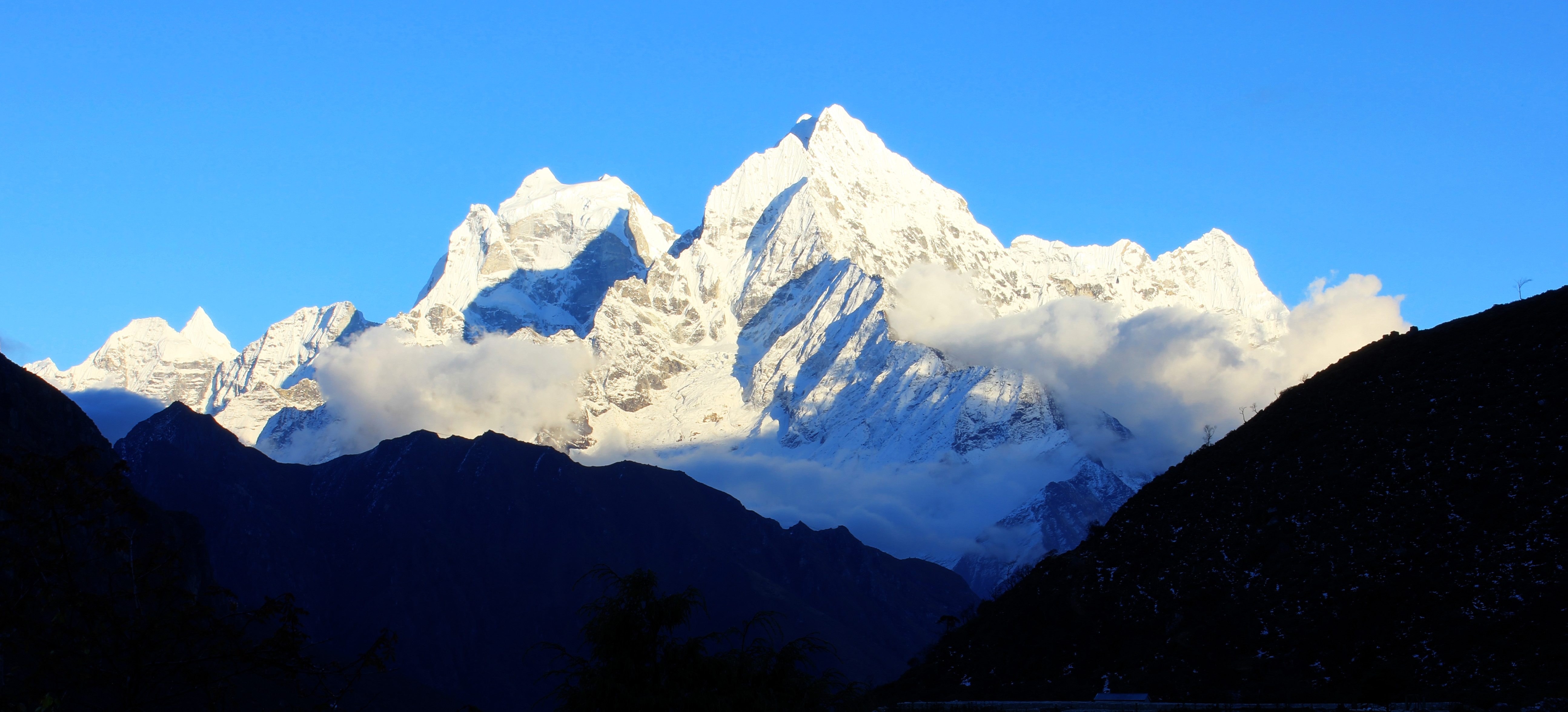
We crested the ridge alongside a small hotel and climbed onto a small knoll that afforded fantastic views of Ama Dablam, and peaking over a ridge in the distance was Everest. Just at that point, an Eagle flew overhead; a sign of something perhaps, but I didn’t know what. After a few photos we walked on to a shoulder on the mountain near to the Everest View Hotel and sat there for ages drinking in the views. Some stunning clouds began to obscure Everest, but Ama Dablam stayed there for all to see for the whole time we were there. Beautiful! As proof of a small world, I chatted to Alun Richardson, a guide who had previously been a member of my climbing club.
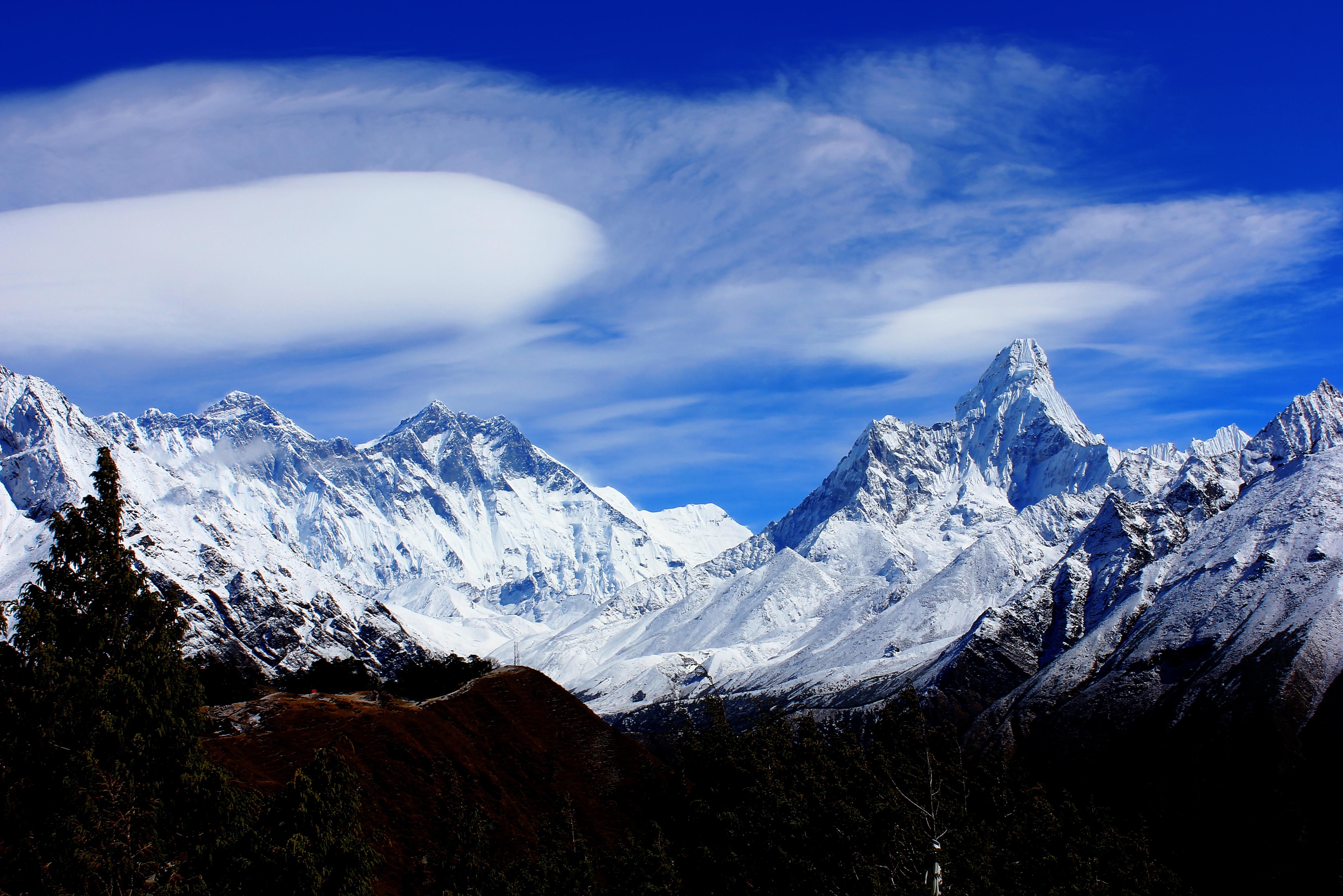
Everest view and Ama Dablam.
The path in the foreground leads to The Everest View Hotel.
The walk back to Namche seemed so much easier and we were back at our camp in hot sun by 1215hrs. Chores, lunch and a shopping trip into town completed a very pleasant day.
Thursday 16th October
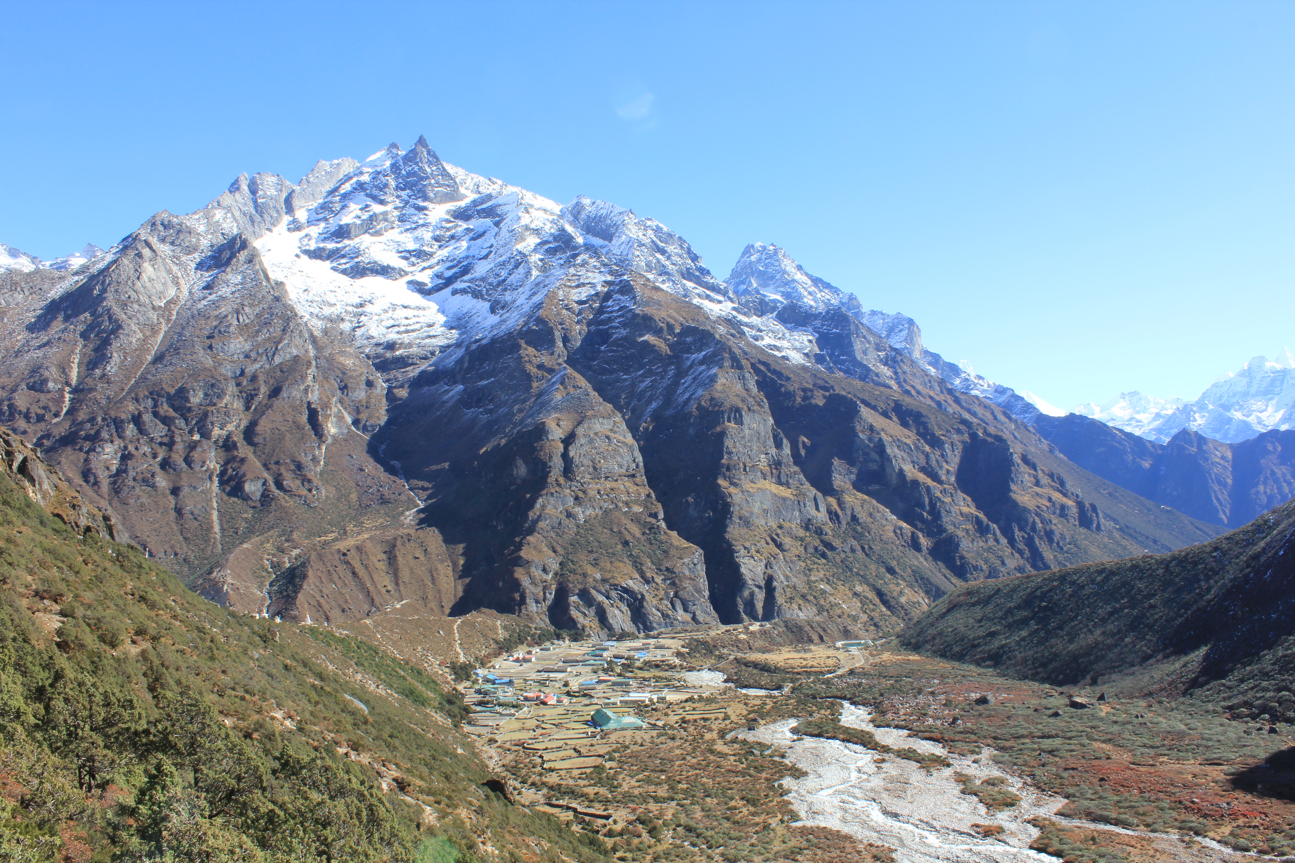
The weather stayed good and the views around us were fantastic. Peaks we had only glimpsed through the gloomy weather on the walk up were now clear and bright to see. Nupla framed the other side of the valley from our tea house, with Thamserku and Kantega forming a backdrop to the south.
By 0815hrs we were on the track, contouring around the top of Namche Bazaar and heading off to the north west along the Bhote Koshi valley. The trail here was immediately much quieter than the main route direct to Everest Base Camp and we saw a lot less trekkers as we followed the north bank of the river through stands of Juniper Indica dotted with plenty of flowers. This is where we first saw Himalayan Trumpet Gentian which we unable to properly identify at the time, but nicknamed the “Khumbu Gentian.”
As well as the natural beauty, the track was lined with colourful prayer flags, stupas and Mani walls, and yak trains passed in both directions.
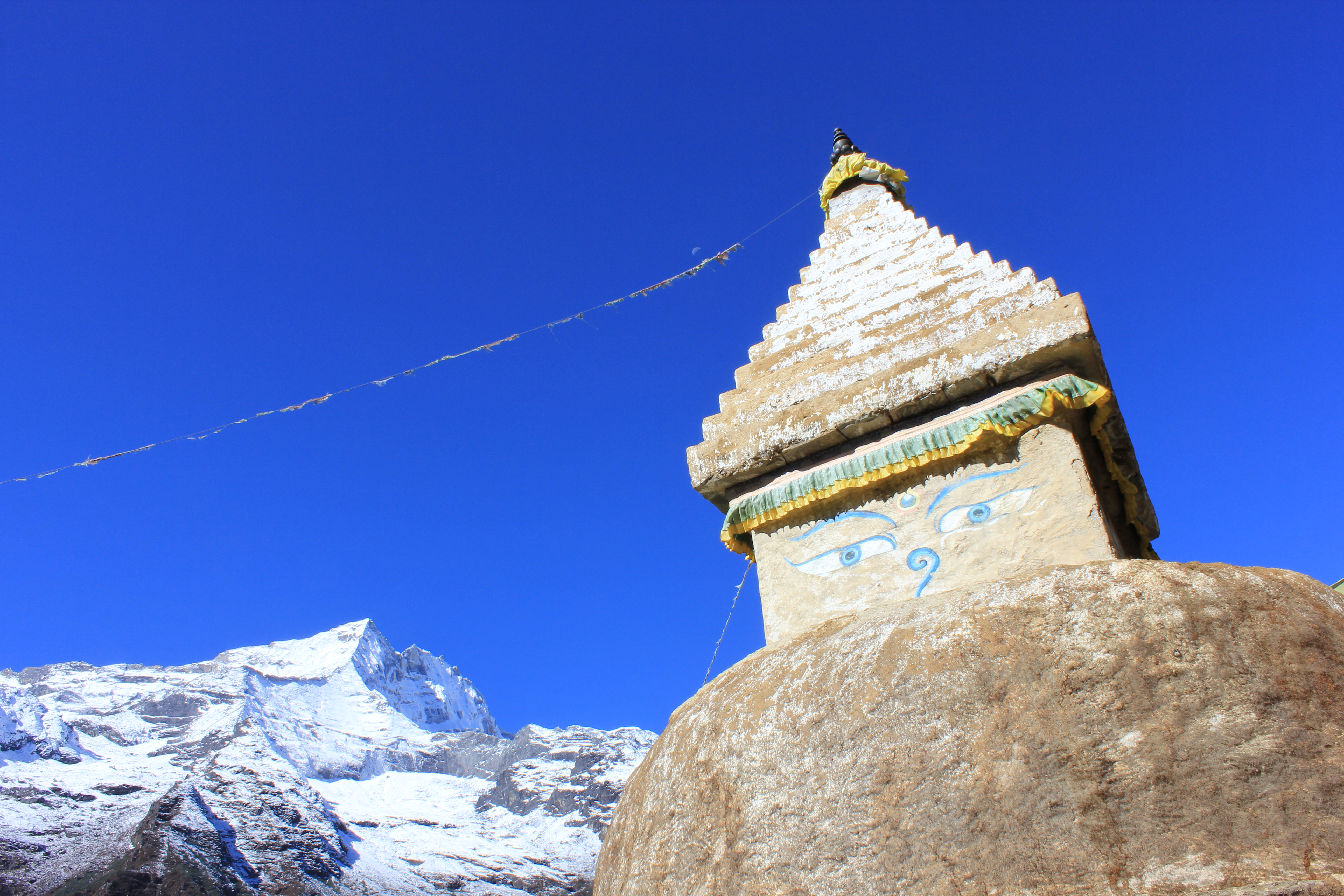
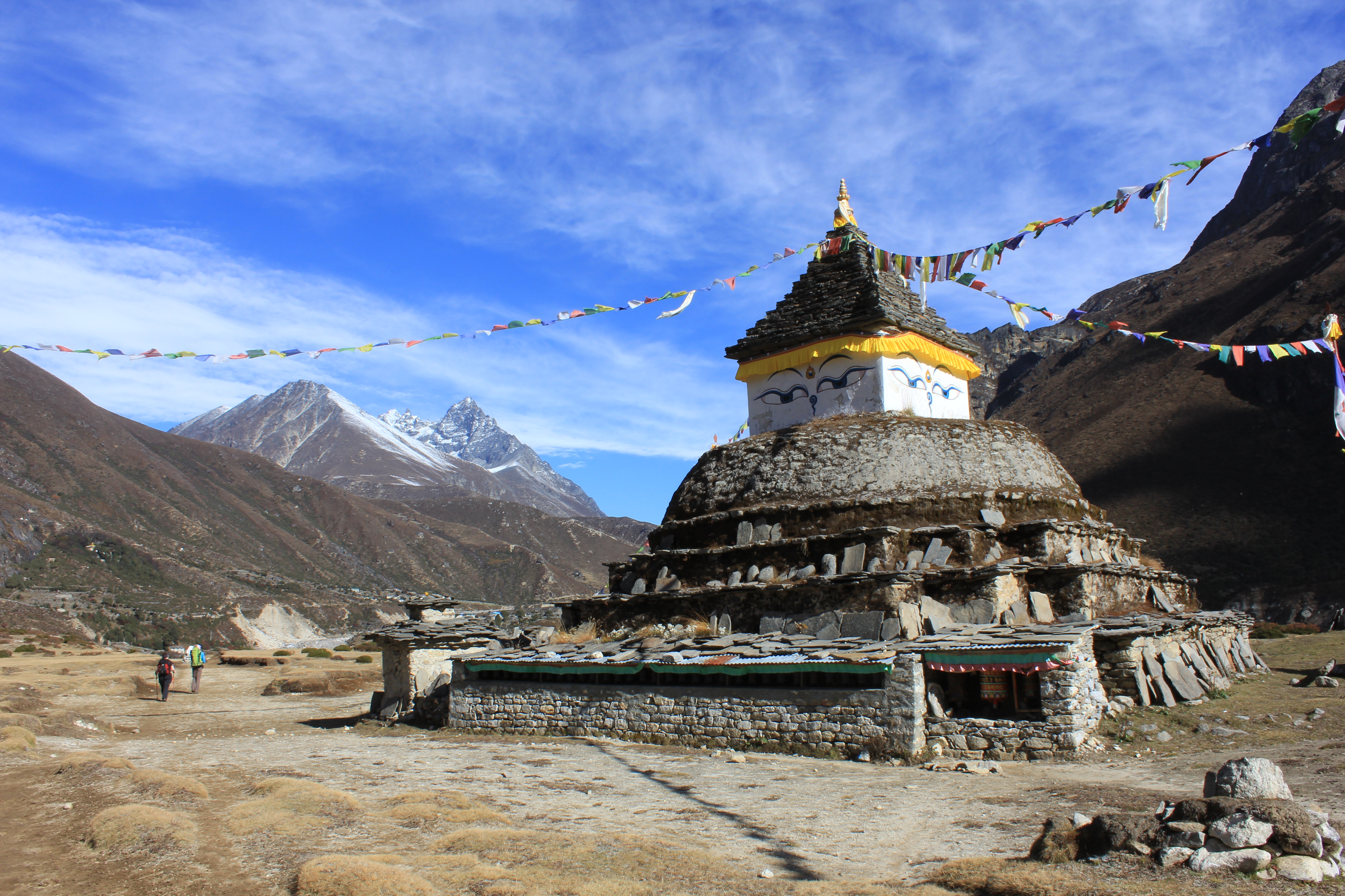
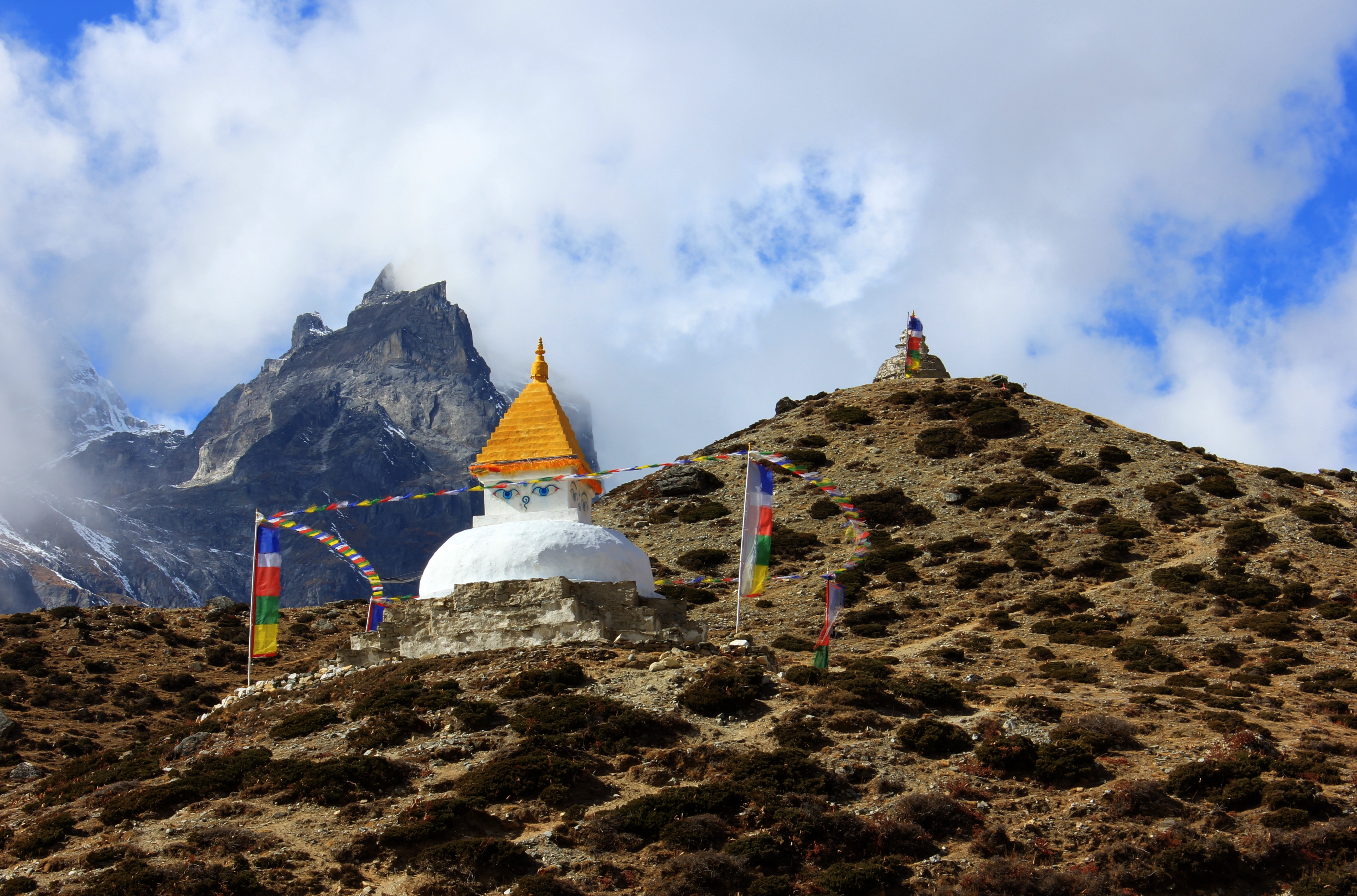
Stupa near Phurte
We took a short break at a large stupa in the village of Phurte, and after that dropped downhill and crossed a little side valley at a bridge over the Thesebu Khola, which afforded great views up to the peak Khumbi Yul Lha.
The view up the Thesebu Khola valley to Khumbi Yul Lha, 5,761 metres.
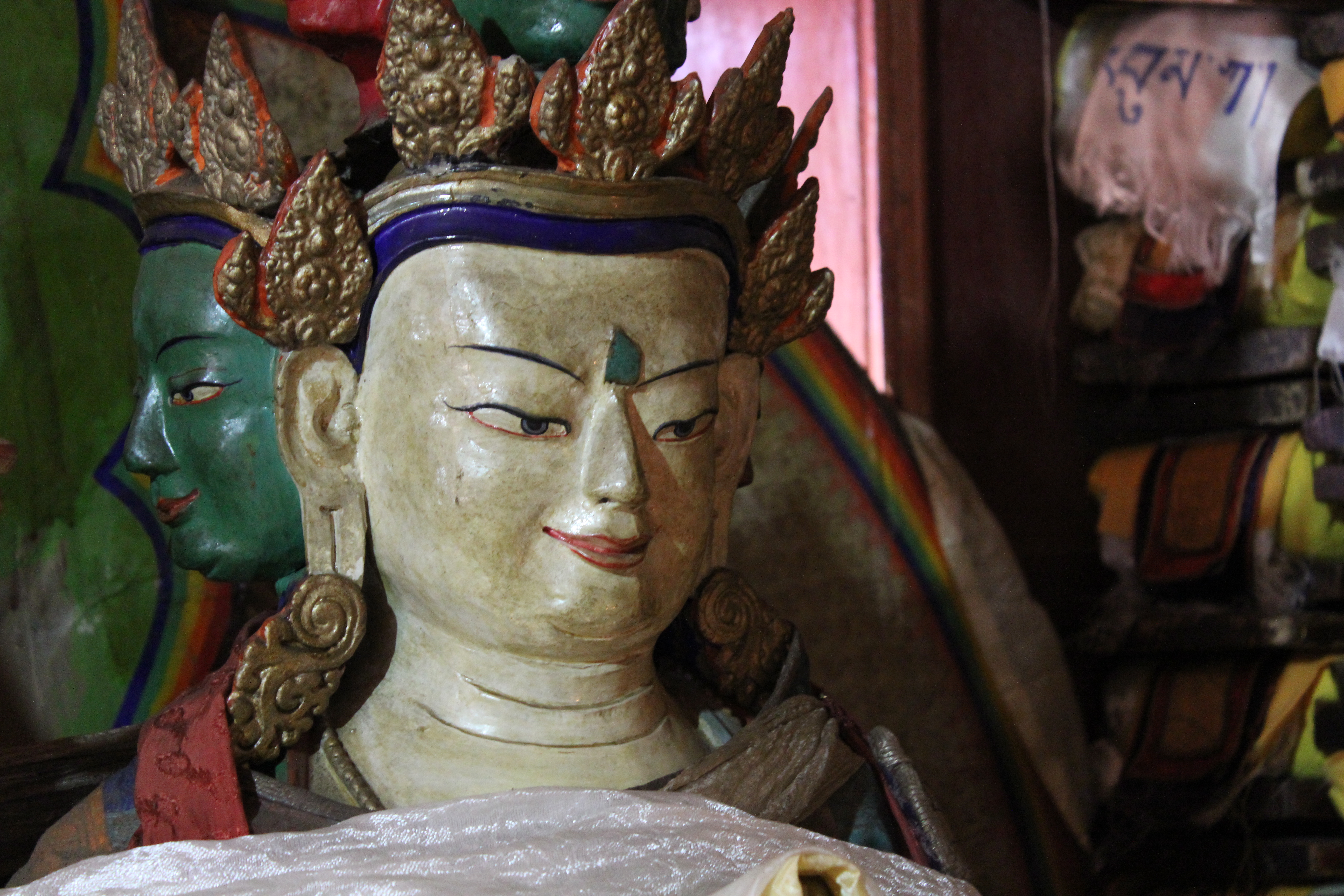
We had an early lunch at Thambo, where we visited the monastery as we waited for our food to be cooked. The monks and nuns were busy building and decorating a new monastery building and it will not be ready for another few years. However, we were invited into the small older temple where a group of elderly nuns were chanting.
Inside the old monastery at Thambo
After another great meal we carried on toward the village of Thame, which was to be our next campsite. The valley was much wider here and there were loose yaks grazing in the undergrowth. As I stopped to take some photos, a bright splash of multi coloured plumage shot along underneath a nearby bush. I slowly stalked after it, and although I caught a few glimpses of a Himalayan Pheasant, every time I brought up the camera, it shot off to another stand of undergrowth, thwarting all my efforts.
At the confluence with the Thame Khola, there was yet another suspension bridge and alongside it was a series of holy paintings on the rock-side, consisting of three pictures of Gods and a section of Nepali text. We crossed the bridge and began the final climb up to the village. The closer we got, the more prayer flags we saw and finally we got to another Kani that marked the entrance to the village. Surrounding us was more Juniper, but this was Juniper Ruperacus, a slightly different version local to that area.
We reached our camp by 1430hrs and settled in for a lazy afternoon. About midnight that night, we could hear a yak bell in the field outside our tent. That was no big deal and not at all unusual, until we heard the bell moving behind the tents. Our camp was set up so that the tents backed onto the boundary wall of the field and formed a small corridor behind, with what was effectively a dead end as it reached another boundary wall. Many of the tents had washing lines strung between them which we had used to dry off our laundry during the day.
The yak had now entered this area and we heard the beast pass behind us just centimetres from our heads. It kept going toward the dead end until suddenly there was a loud snort, a rustle of tent fabric and a short but sharp scream! It seems that the yak had found himself in the blocked end between the tents and wall and had picked a slightly bigger gap between the two end tents to make his bid for freedom. However, he hadn’t spotted the washing line until he blundered into it, ripping Alex’s flysheet from her tent on his way. The guy lines on Hugh and Richard’s tent were ripped off and the yak blithely continued on his way.
Friday 17th October

Thamserku dominating the far horizon.
This was another acclimatisation day and a few of us decided to walk up the valley alongside the Thame Khola. Six of us set off along the path which began to climb up the steeper side of the hill toward the monastery. Thinking that this was just the way to the rest of the town, we decided not to follow the path, but to follow the actual river itself along the flat valley floor. It was just a series of glacial ribbon streams rather than a single big river, and we picked our way between the boulders and bogs as we tried to find a dry route up the valley. We realised that we should have actually stayed on the original path and that after it passes the monastery, it continues up the valley toward the Tesilapche La. We flogged directly up the side of the steep hill alongside a tributary stream, threading our way between bushes and trees as we sought out the higher path.
The peak of Kapsale, 5,583 metres sitting above Thame
We reached a faint track heading in the right direction and followed it to a small pasture, where it faded away. Some more bushwhacking found another skinny path which led to a set of walled pastures inhabited by a couple of yaks. There wasn’t a cloud in the sky and the place was really beautiful, so I elected to stay there whilst the others went on. The main path was another 35 metres or so higher up the hill and I made my way up there to wait for them. I saw more Khumbu Gentian, Stonecrop and Sundew. Alpine Choughs wheeled over my head just three metres above me and about fifty metres away, a Kestrel hovered and swooped over the slope hunting for it’s next meal. It was an idyllic place to sit and enjoy the world.
Thamserku, 6,608 metres with Kantega, 6,685 to it’s left.
When the others returned, we walked back to Thame and visited the monastery there. The novice monks were in the classroom learning their chants and the sun shone down brightly on the courtyard as we sat there listening. Inside the main building were Tibetan books wrapped in their protective shrouds, big brass horns and conch shell trumpets. Above the entrance was the ritual symbol found at most monastery entrance doors. A pair of Musk Deer flank a large Lotus Flower with a Wheel of Life sitting above it.
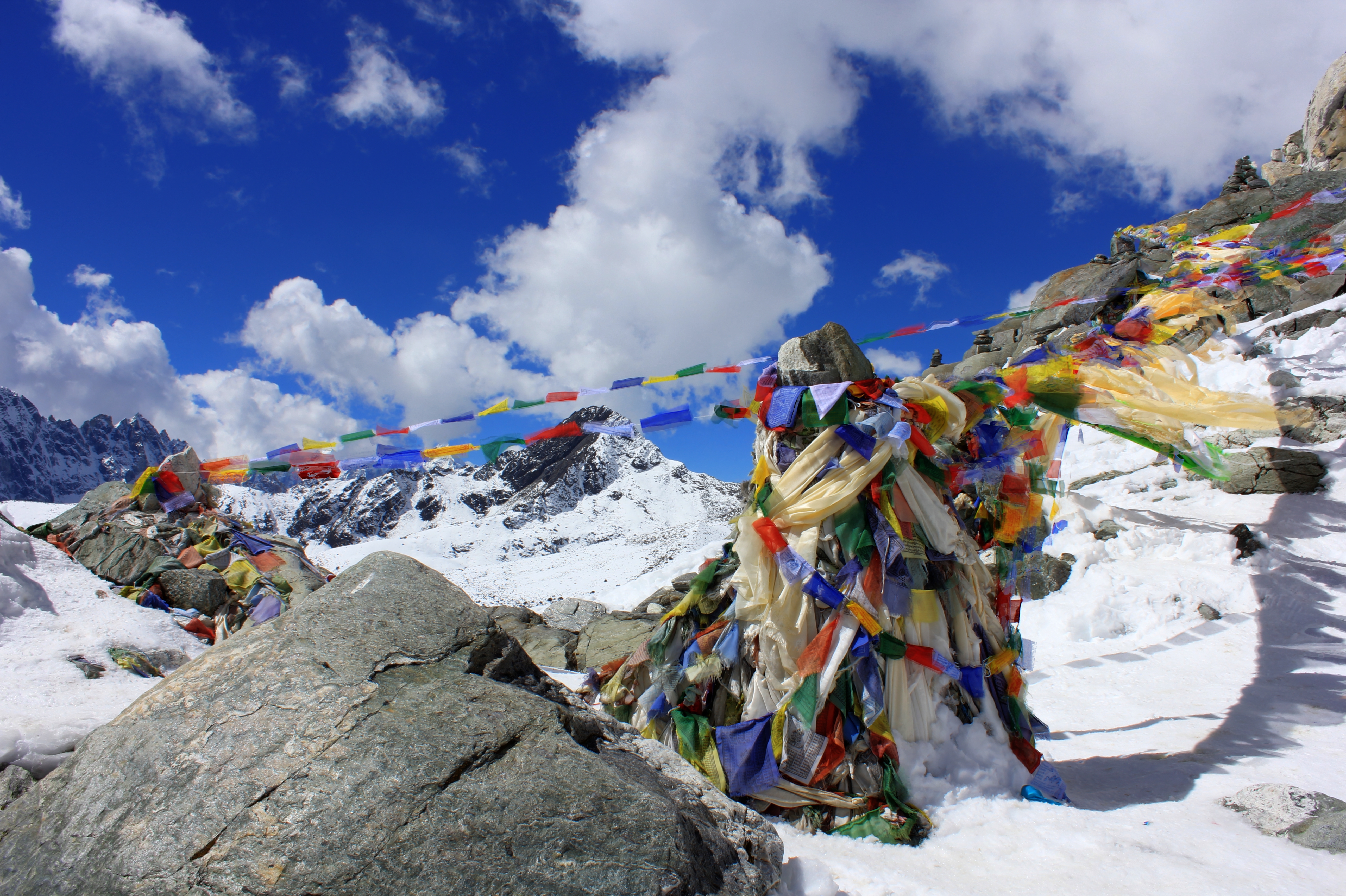
Leading up the ridge from the Kani to the monastery were a number of Chortens and Stupas and the ever present Prayer Flags.
Prayer Flags There are two kinds of prayer flags: horizontal ones, called Lung ta (meaning Wind Horse in Tibetan) and vertical ones, called Darchor (flagstaff).
Darchor are usually large single rectangles attached to poles along their vertical edge. They are commonly planted in the ground, on mountains, cairns, and rooftops.
Lung ta are commonly hung on a diagonal line from high to low between two objects (e.g., a rock and the top of a pole) in high places such as the tops of temples, monasteries, stupas and mountain passes. They come in five colours, arranged from left to right in a specific order: blue, white, red, green, and yellow, representing five elements. Blue symbolises the sky and space, white symbolises the air and wind, red symbolises fire, green symbolises water, and yellow symbolises earth.
We got back to camp by 1215hrs, with loads of time for hot juice, snoozes, showers and chores. We even had time to drag out the Portable Altitude Chamber and get ourselves acquainted with it for the unlikely event that we would need to use it in the future.
Saturday 18th October
We left camp at 0815hrs with a bit of cloud and a slight breeze, but in what was essentially good weather. As soon as we left our campsite, the path climbed steeply over the ridge that lead to the Monastery, and dropped back down the other side back into the main Bhote Koshi valley. There were still a lot of Mani walls, flags and Stupa this close to the religious site, but the view ahead showed a much more austere part of the world. We were now heading above the tree line and moving into the world of stones, scree and snow. There were still plants about, but the gaps between them got bigger the further we went. The path followed the west bank of the river and although it undulated up and down, it always got higher the further north we went. I saw Asters, Snowbells and loads more Khumbu Gentian. The ever present Choughs wheeled above our heads. Behind us, tons of clouds boiled up the valley to the south and we knew they would eventually block out the warm sun.
Traders and pilgrims from Tibet pass this was on their journey from the Nangpa La to the south.
At 1025hrs we had a short stop and at 1115hrs we crossed the stream and got to our lunch stop at Maralung. The cook team were getting more organised now and food only took an hour from start to finish. Even in that relatively short time, the temperature had dropped and most of us were now in hats and gloves as we continued up the valley. The clouds were also above and ahead of us now and occasionally they parted to allow us glimpses of Cho Oyu on the border with Tibet. We got to Lungden village at 1415hrs and settled down to hot tea in the Lungden View Lodge. Mind you, with cloud now all around us, there was no such view left and we were glad to be in shelter for the rest of the day.
By 1530hrs, what we thought was going to be a shower of rain was in fact reasonably heavy snow. We sat by the stove as it got gradually warmer, powered by a bit of wood and a lot of dried yak dung. Just an hour later, the snow stopped, the clouds cleared and the views all around returned to their previous state of delightfulness. You had to be quick with your camera if you wanted photos though, as we could see the next bank of clouds rolling up from the valley below us.
Sunday 19th October
Wow! What a view! We woke up to clear blue skies with just an occasional breeze to keep the temperature down. I even contemplated walking in just my T shirt but changed my mind at the last minute and stuck a jumper on. We set off at 0845hrs, having enjoyed a few extra cups of tea after breakfast, so the porters had plenty of time to get ahead of us. Our next camp would have no tea house near it and they wanted to make sure we had tents pitched before we arrived in case the weather turned bad again.
Sun hitting higher peaks above Lungden.
We headed off north out of the village and then turned north east onto a ridge taking us up onto higher ground. The snow was a few centimetres thick but our path was already clear because of those who had gone on ahead. In the lee of boulders, the snow banked up a little thicker and the bright sun melted snow so that it run in little rivulets and formed small pools of gloopy mud.
No doubt about it, this is the way!
The spur led us into a small hanging valley with a snow covered lake and a beautiful little hafod that had stunning views in every direction. More Choughs wheeled overhead and Fox tracks led off across the snow. The path flattened out before it made it’s final rise up to the shore of Relama Tsho (Lake). Just above that was our campsite, sitting below a slope at the side of the valley in a little walled enclosure. The sun dazzled off the snow and at 1155hrs we reached the tents to be handed mugs of hot juice by the cook team. The sun’s glare gave a fierce heat but we knew that wouldn’t last. As there was no tea house, we sat shura like in a large tent, with a thin tarpaulin between us and the snow.
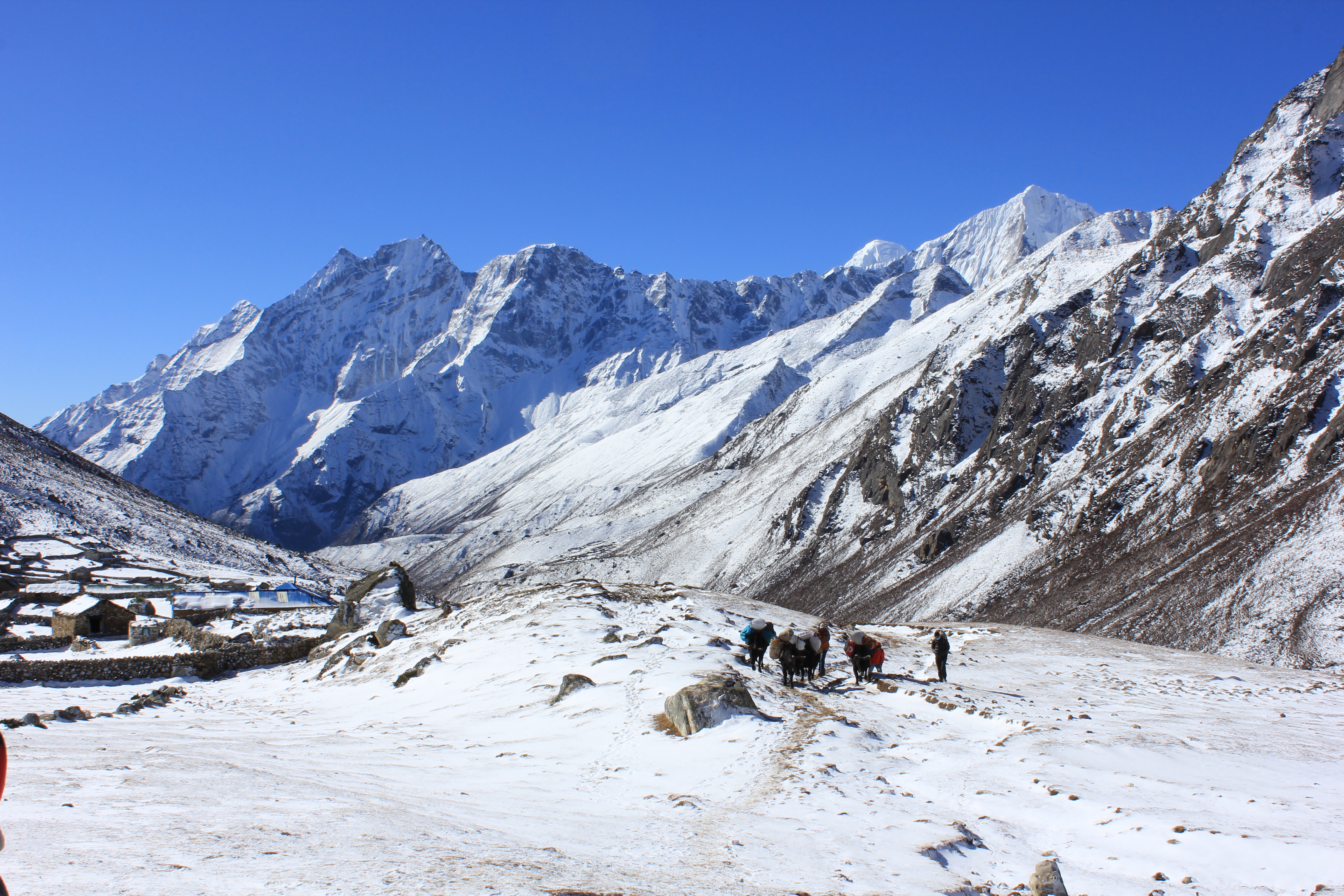
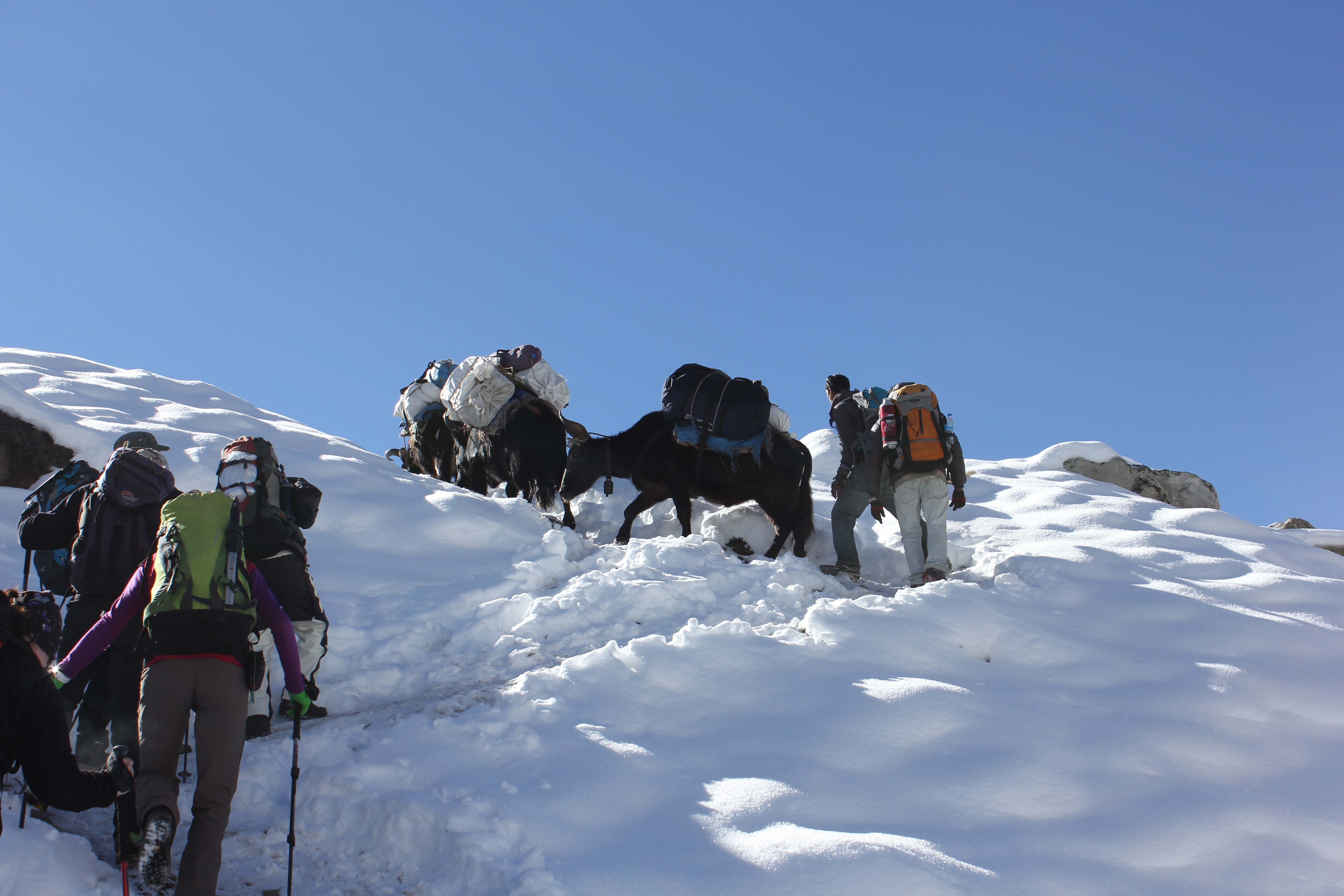
Our Yaks leaving Lungden on the way toward the Renjo La.
After lunch, there was plenty of time for chores, but already it was getting colder as the clouds caught us up. By 1540hrs the sun dipped below the surrounding mountains and the cold really began to bite. It was time to retire into individual tents and wait for an early evening meal.
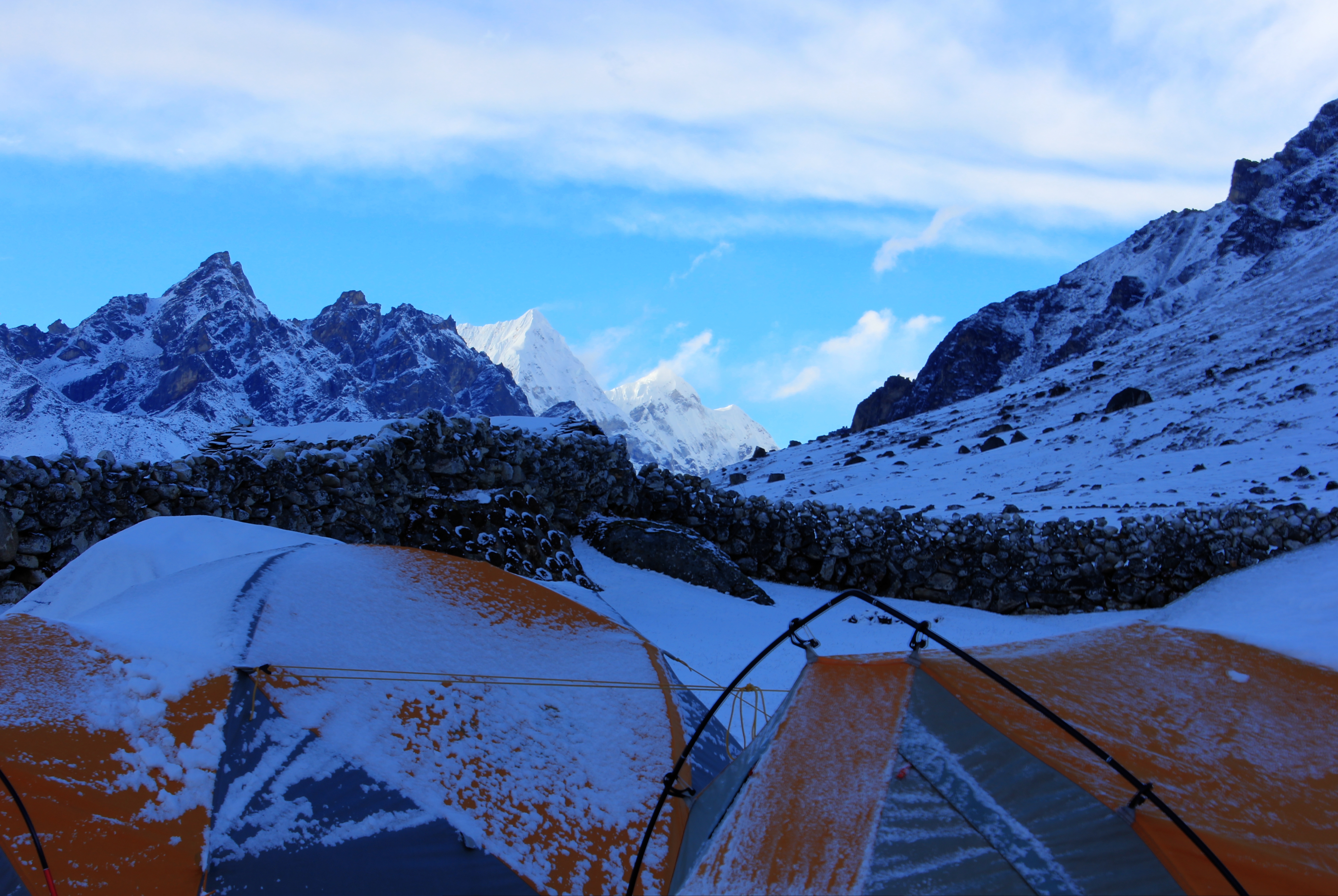
We ate at 1700hrs and by now it was bloody freezing. Everyone was in their own tent by 1800hrs and I couldn’t even read after 1900hrs as it was too cold to keep my hands outside the sleeping bag. Richard’s thermometer clocked the night time temperature as minus 16C.
Our campsite was just below 5,000 metres and well above the snow line.
Monday 20th October
An exceptionally cold start! Even the contents of my pee bottle had turned to semi frozen slush overnight. Bed tea was at 0600hrs and breakfast another hour later. Because we were in a bowl in the mountains, direct sunlight was nowhere near us yet. Because we were eating in the big tent, everyone anticipated staying cold for a while and a few people actually elected to eat outside standing up rather than come in and take their boots off. Those of us inside sat with our gloves over our toes so that we looked like badly dressed extras from a poor production of a Planet of the Apes film. By 0745hrs we were strapping on our rucksacks to start the day’s walk when the sun reached us. Within minutes it turned from a freezer to a furnace. Very occasionally there was a light breeze, but they were few and far between, so quickly people were stripped down to a layer or two as they walked along.
The route takes a line toward the right side of the picture and crosses the horizon about a third in from the right hand side.
Near the track a small flock of Tibetan Snowcocks ran along beside us and there were numerous sets of small rodent tracks in the snow. The path ascended gradually as far as the Angladumba Tsho (lake) but from there it got much steeper. The yaks caught us up and passed us, but even they were struggling. One of them was really hesitant and despite much shouting and butt whacking, looked like it would refuse to go higher. Suddenly it slipped and began to pirouette on it’s hind legs until it regained it’s balance. Only then did the yak driver relent and allow it to pick a more meandering but amenable route up the next section.
The steep bit was hot and hard going. The climb from our camp to the top of the La (pass) was four hundred metres, and nearly all of that gain was here on this one slope. The views were stupendous but hard earned. The Prayer flags at the actual pass came into view above us and beneath them was a series of stone steps laid into the hillside, which must have been a gargantuan task when they were put down. A final snowy ramp crossed the headwall from right to left and it seemed to hang off the wall like a scene from a Tintin cartoon.
The ramp was easy going apart from the altitude but had a big drop off on one side.
The pass itself was busier than the track as people were crossing from both directions and naturally they congregated there for photos, lunch or just a breather. It was 1145hrs and we did all of those things; lunch, photos and a rest. Our cameras whirred as we looked over at the west face of Everest still several days walk away from us. In supporting roles were Nuptse and Lhotse, with even a little part of Makalu visible in the far distance. There were so many peaks to be seen that I couldn’t begin to name them all or even remember every name if someone could have told me. A lifetime of brilliant climbing was visible in a single view.
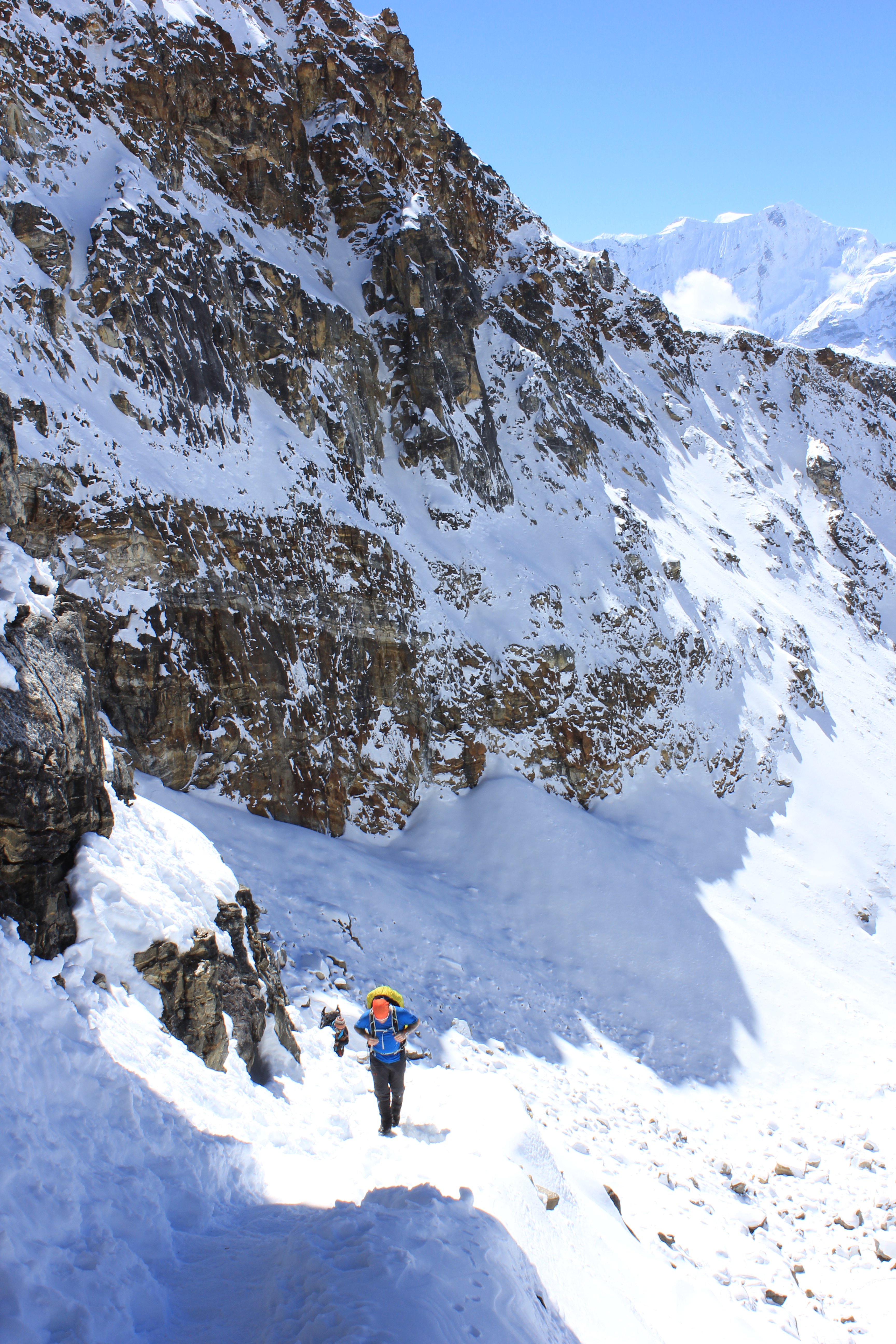
The path started steeply down a well-trodden snow gully with occasional icy patches. After the steep zig zags it levelled out for a while. Sometimes there was muddy slush underfoot, sometimes snow, ice or loose rock. Most of us took a small tumble or slide at some stage. Then it plunged down steeply again over loose scree and snow until it was nearly level with the startlingly azure coloured Gokyo Lake, where it finally levelled out again and contoured around the northern edge at the base of Gokyo Ri. The town was clearly visible and we knew we were close when we saw one of the cook team waiting for us with a big kettle of hot juice. The path finished over a set of stepping stones at the edge of the town with glimpses through the cloud to Cho Oyu, which formed the northern head of the valley. It was 1530hrs and the end of one of the longest day’s walking so far.
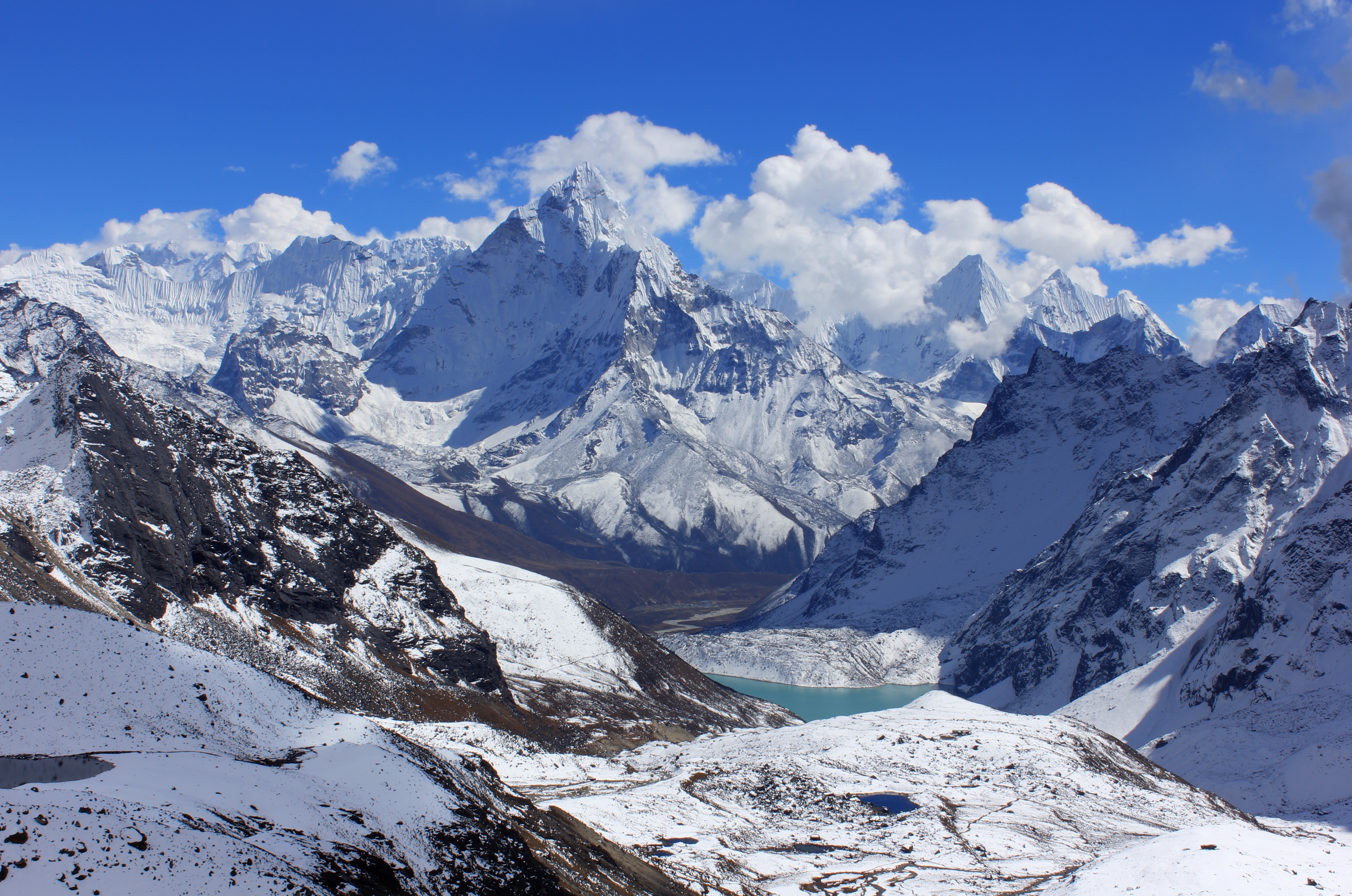
Looking over Gokyo Lake with Everest behind it.
Tuesday 21st October
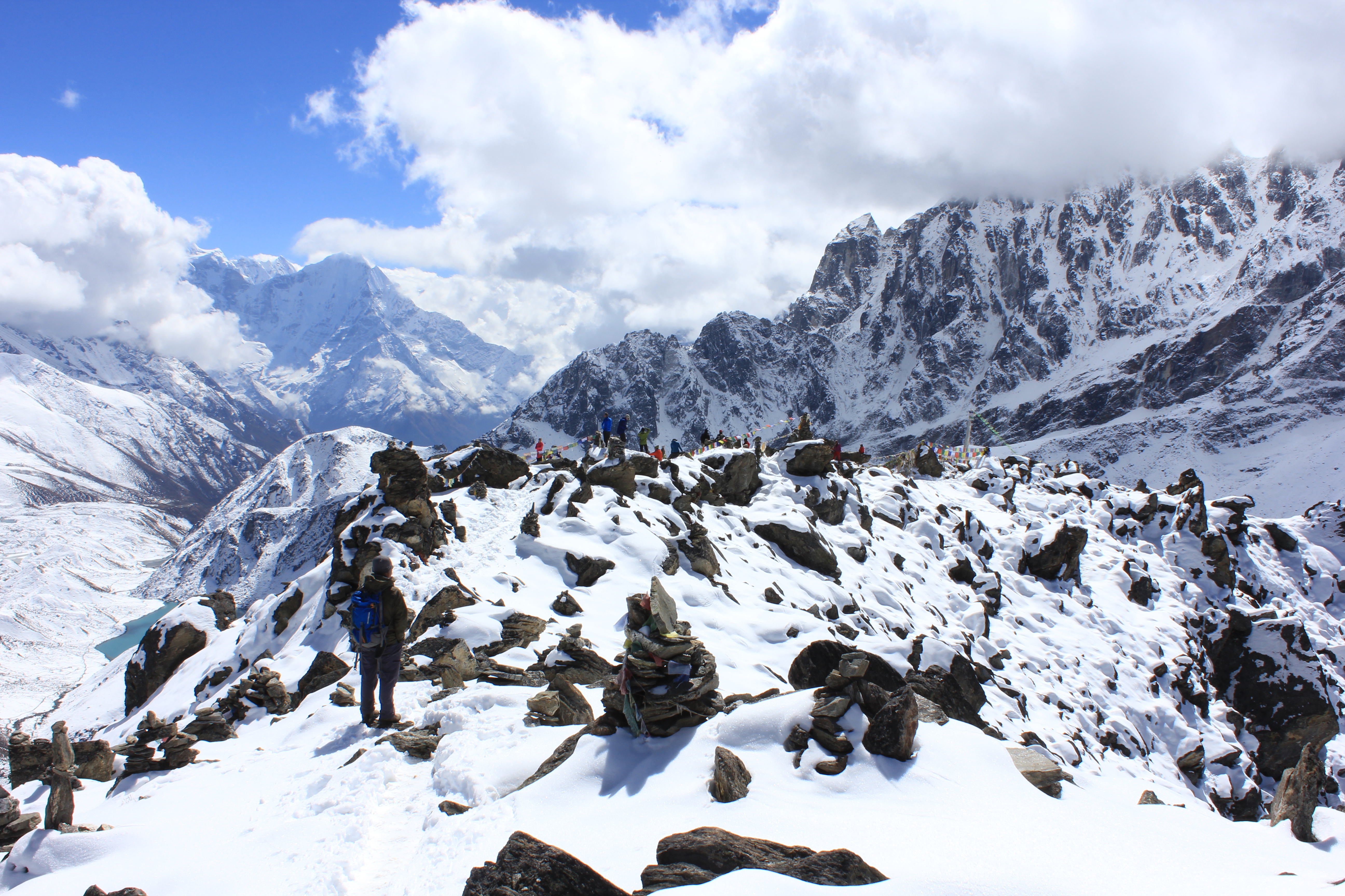
Another acclimatisation day meant a more leisurely start and we didn’t leave camp until 0910hrs. Lisa, Helen and Richard elected to stay in camp while the rest of us set off for Gokyo Ri. We crossed the stepping stones and from there the path rose straight up the side of the hill on a muddy path. We elected to walk at crawler pace rather than “stop / start” as we made our way up to the 5,360metre summit.
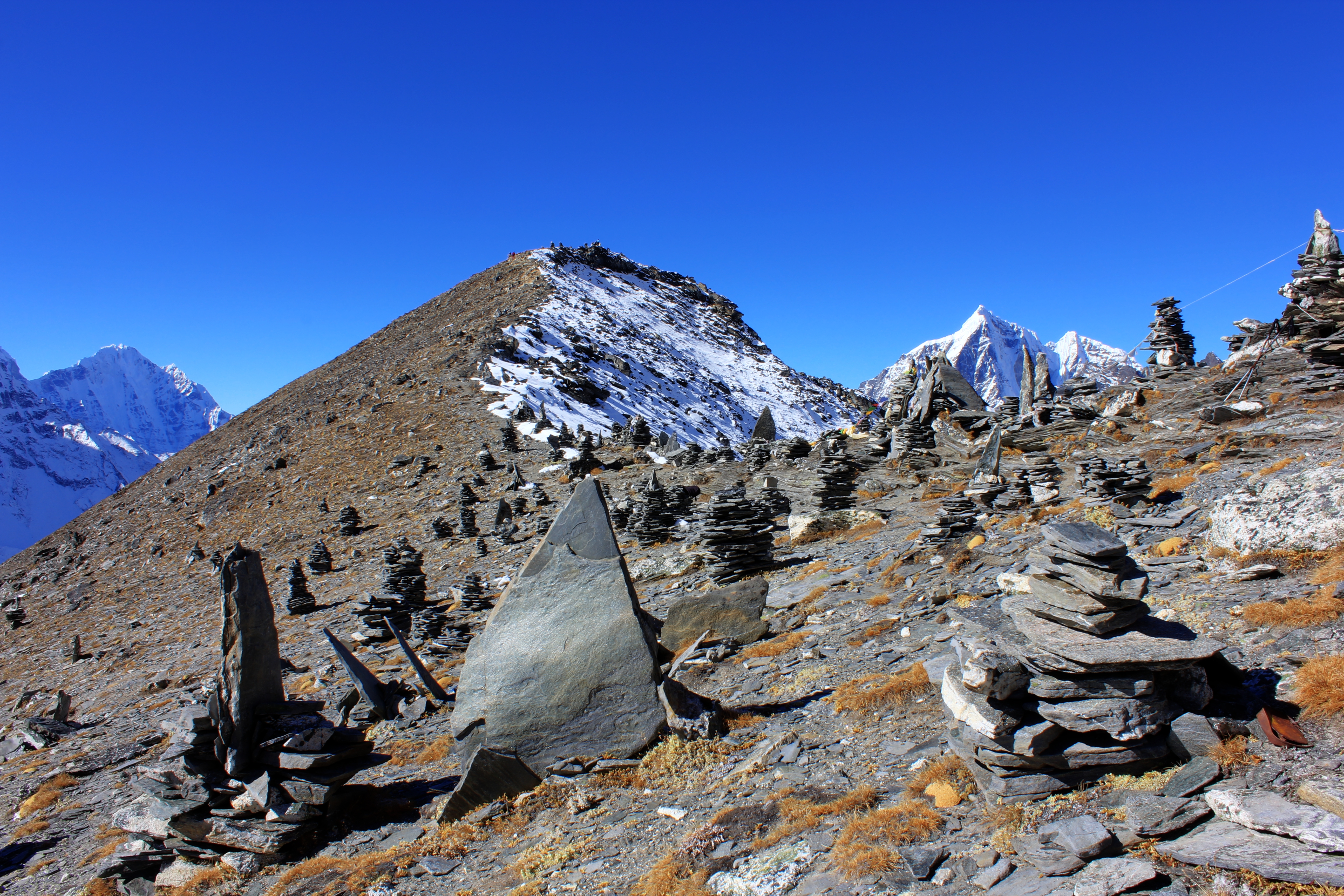
Above us an Eagle soared in the thermals and alongside us numerous cairns marked the way. Some of them were simple piles of stones while others were more elaborate balanced and cantilevered rocks.
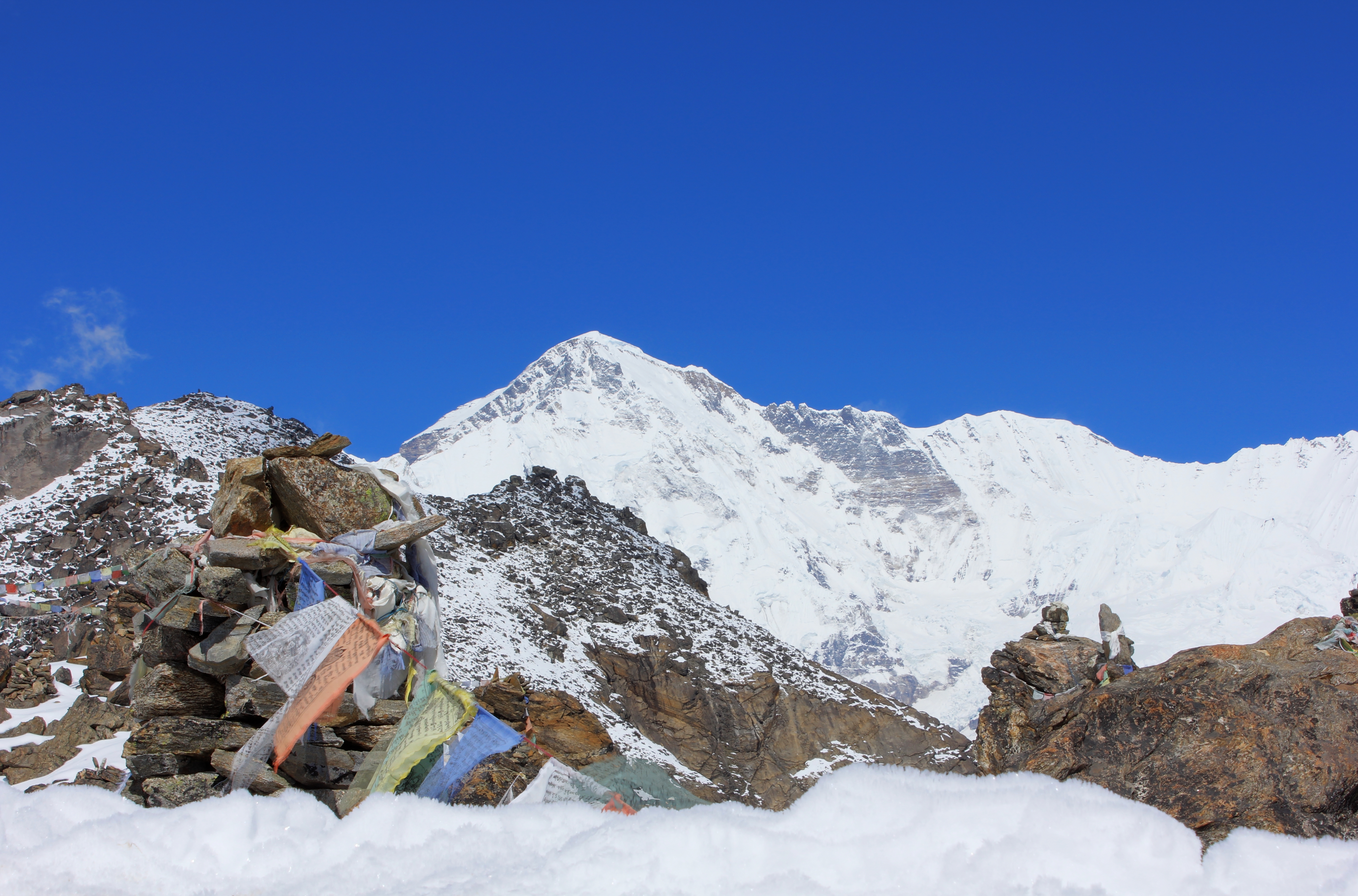
The summit of Cho Oyu as seen from Gokyo Ri.
Cho Oyu is the sixth highest peak in the world at 8,201 metres.
We reached the summit prayer flags at 1115hrs and soaked up the view around us. It was much clearer to the north and Cho Oyu stood out proudly. A slight saddle led to another part of the peak which I thought was slightly higher so I made my way across there where it was quieter. After around 30 minutes we began our descent, with some of the team practically running down! The slower moving people, me among them, saw vultures scouring the slopes above us.

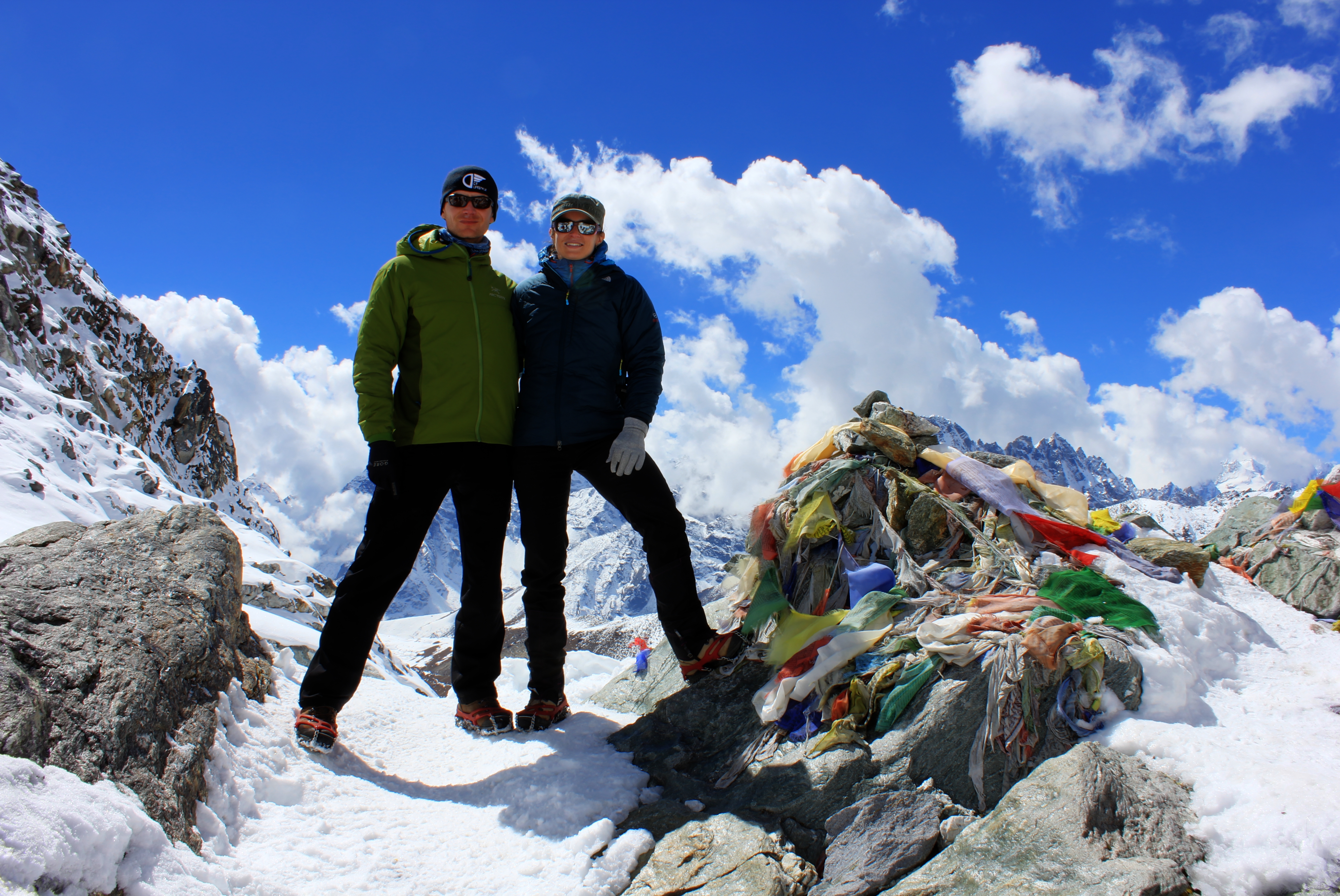
Our team at the top.
Looking down at the fore summit of the peak.
We were all back at camp by 1230hrs and after lunch completed our chores before we hunted out cake and WiFi. As Lisa and I made our way back to our tent, we threaded our way between some yaks in the yard next to the tea house. No sooner had we passed them than two of them started to fight and one of them did a complete 360° roll down the slope we had just walked across!
The view back the way we had come.
The pass toward the right hand side of the picture and the route down takes a line in the right hand third of the picture.
Wednesday 22nd October
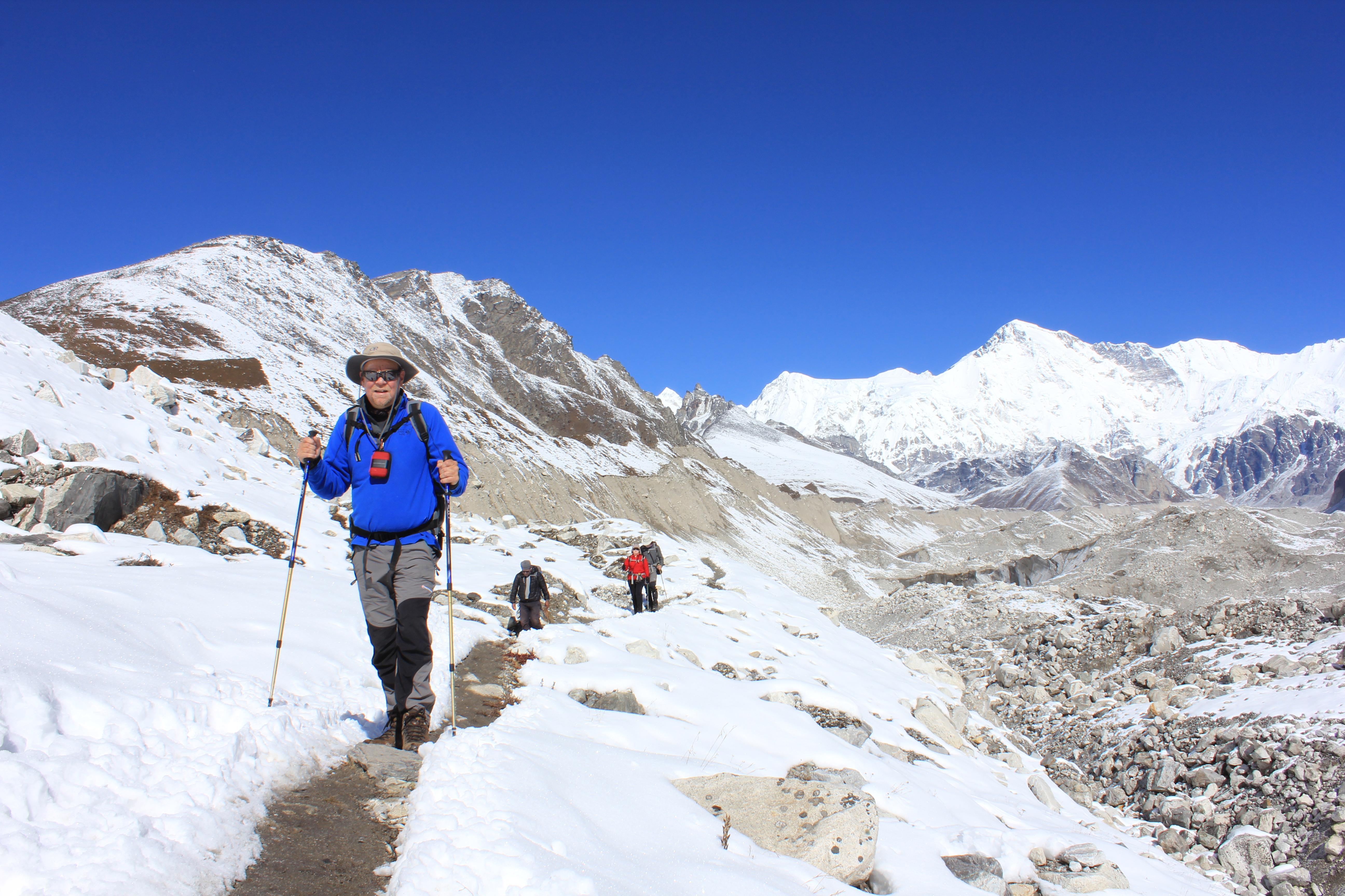
After another leisurely start we left camp at 0850hrs. The glacier reached right up to the southern edge of town and our path took us straight up the lateral moraine and onto it. It had snowed in the night and the whole scene was glistening and pristine. The yaks moved ahead of us and as soon as we were in the direct sun it was warm and seemingly benign. Often the path was sandy or fine gravel, sometimes snowy, icy or muddy. The views were fantastic and again, Cho Oyu stood out at the head of the valley guarding the border into Tibet.
Yaks ahead of our team as we top out on the climb out of Gokyo and onto the glacier.
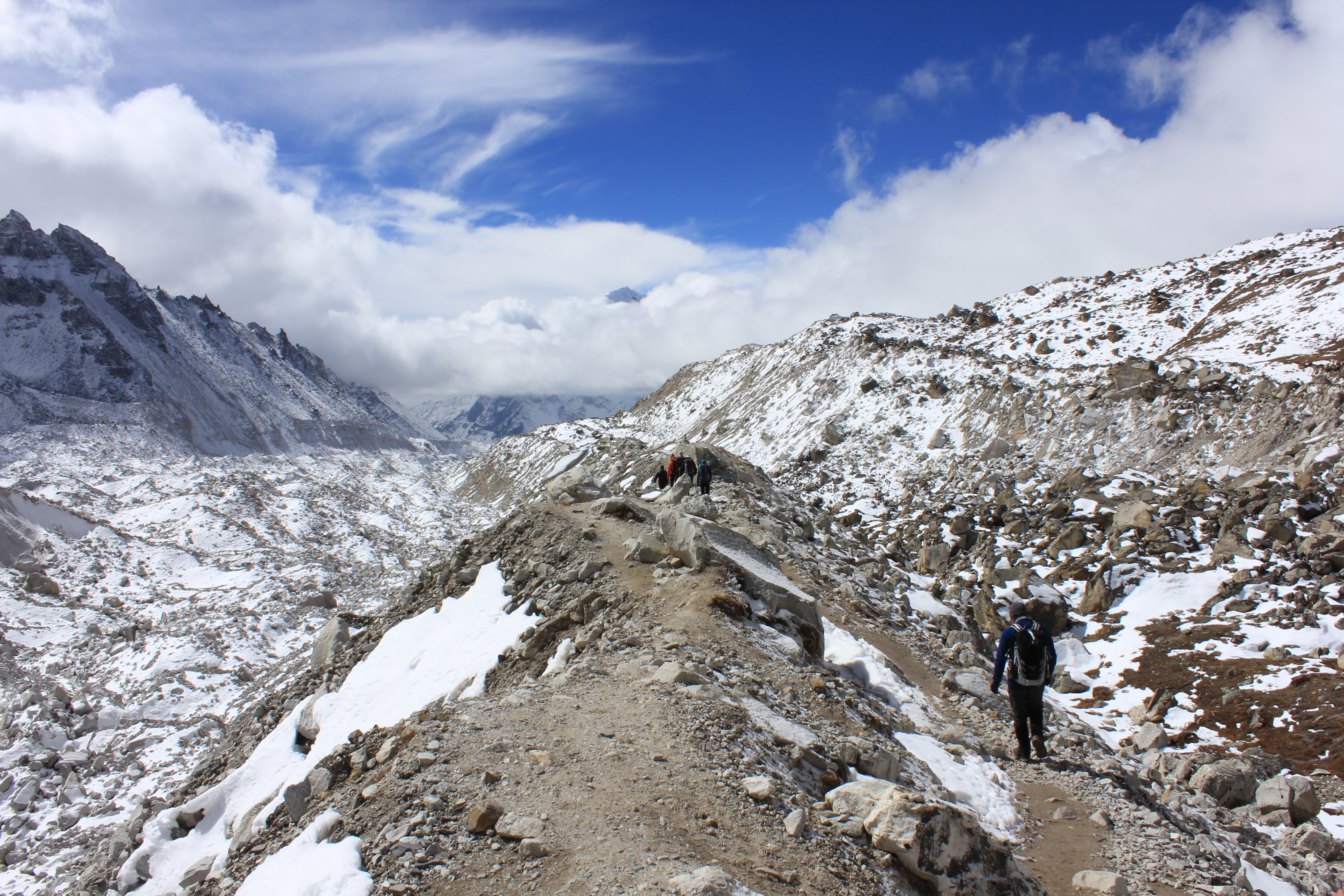
We crossed the glacier until we reached the other lateral moraine. The side of the valley above it was treacherous looking and huge boulders floated precariously on beds of steep scree. The path took us for 400 metres below this crumbling wall, with glacial meltwater pools and boulder chokes on our other shoulder. Alex gave a clear briefing to our team. Move along the path one at a time with at least ten metres between each of us. That would allow you to run out of the path of any landslide without crashing into your companions, should you need to do so.
Richard crossing the glacier with Cho Oyu on the horizon.
Sadly, some other teams in the same place didn’t see the danger as we did. They ambled along under the dangerous ground, bunched together and apparently oblivious to any impending misfortune. They even stopped for a chat and to look at something on the mountain. Fate was on their side this time and they carried on their way blissfully unaware of what could have happened.
The glacier was covered in rock and scree.
We took our turn under the dangerous ground and made our way to a more stable area. After that there was a short steep slope up the scree and we would be back on safe ground again. The plan was to ascend the slope spaced out again but we couldn’t hang about too long as a yak train was coming along behind us. We moved up and onto good solid ground, following first a path along a grassy flat section, then a small stream that threaded it’s way through a boulder field. We arrived at the village of Thangnag by 1130hrs and as we had an early start for a long day tomorrow, we took rooms in the Tashi Friendship Lodge.
A view of the peak from the glacier.
Thursday 23rd October
Whilst the luxury of room overnight had been great, it was really cold at the 0530hrs breakfast. At 0615hrs we were stepping off alongside the Thangnag Kharka (stream) and following it up a side valley. Although dawn had broken, we were shielded from the sun by the high ground alongside us. However, we could see it tantalisingly warming up the floor ahead of us and looked forward to getting into it’s warm zone. As if they were also trying to get warm, a big flock of Himalayan Snowcock ran down the slope just metres to our right. Some of the team were walking quite slowly, but it was just too cold to wait for them until we reached the sunlight. Finally, just below the col, the sunlight reached us and it went from freezing to basking in a matter of minutes.
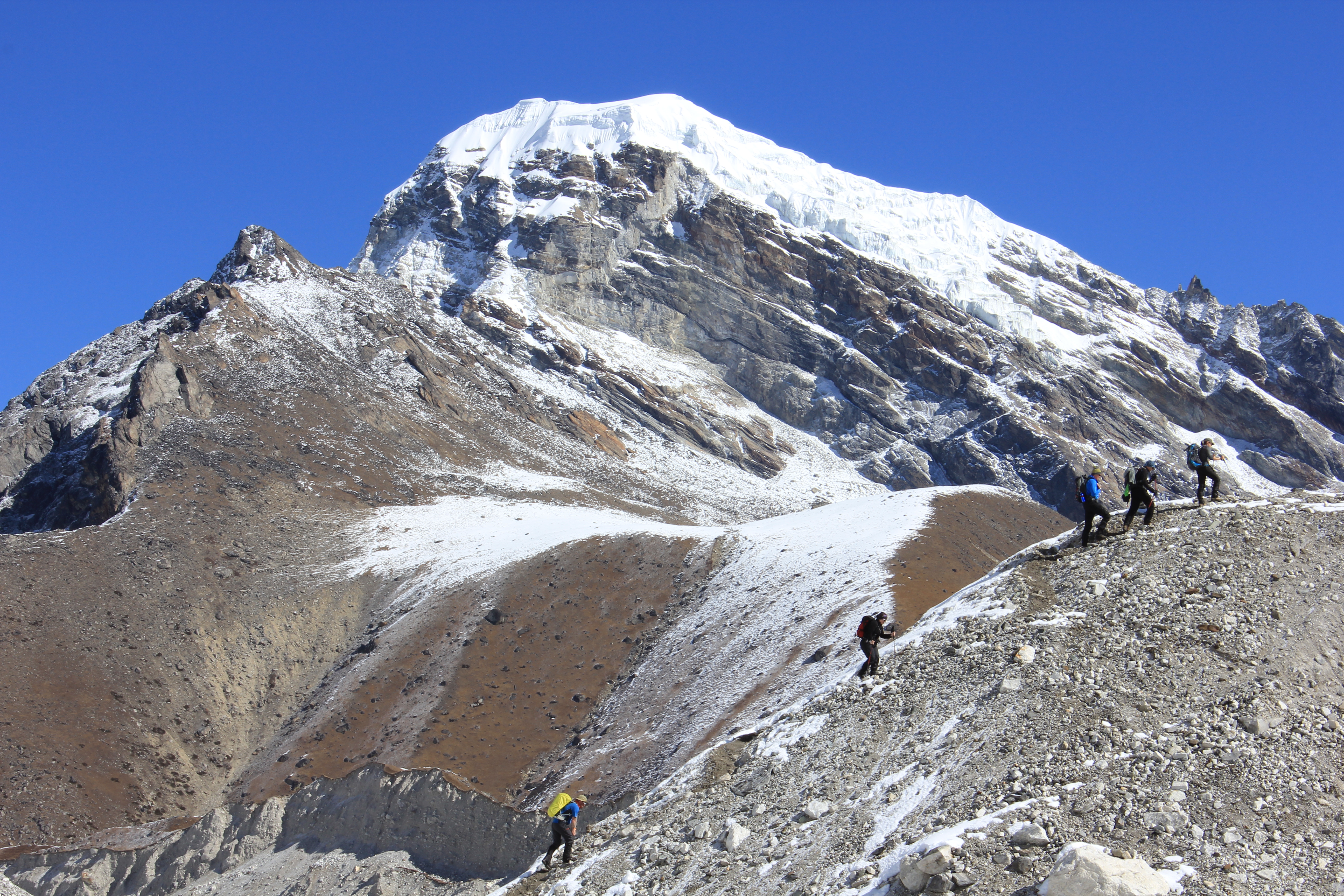
We topped the col and dropped down the other side of the hill before crossing an old boulder field left behind by the receding glacier. We picked our way up the lateral moraine and by 1010hrs we were sitting at the base of the steep ascent to the Cho La. We donned our micro-spikes and began the big climb.
The path can be seen on the right hand side of the screes heading toward the saddle.
It was mostly snow, but sometimes thick mud or gravel. The path climbed steeply, criss-crossing the slope, with the occasional hole between boulders ready to suck you down if you day dreamed.
Just before the top, we met an elderly English woman who was being lead slowly by the hand down the slope toward us. She looked shattered and I doubted whether she was going to enjoy the steep and slippery descent.
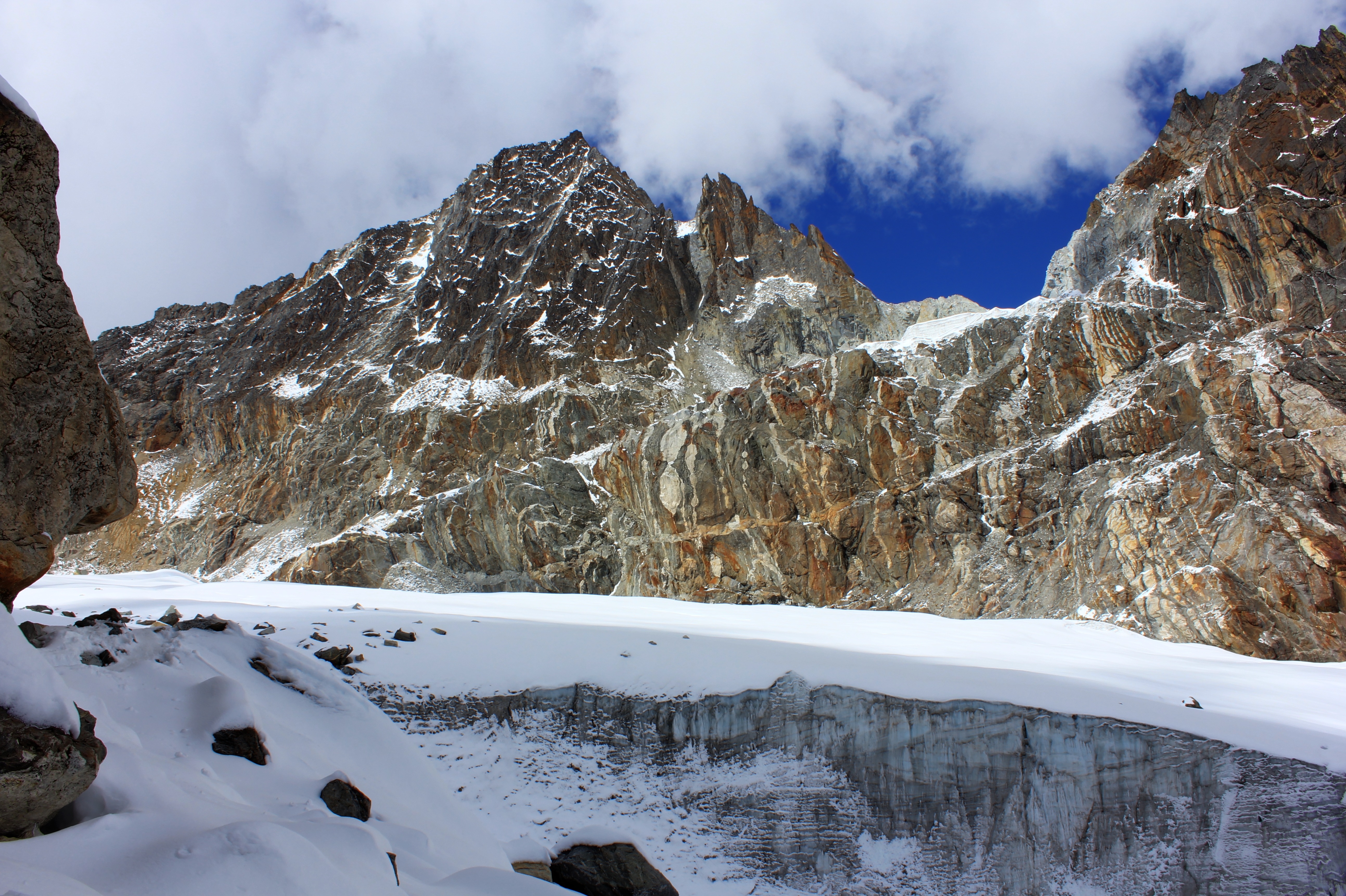
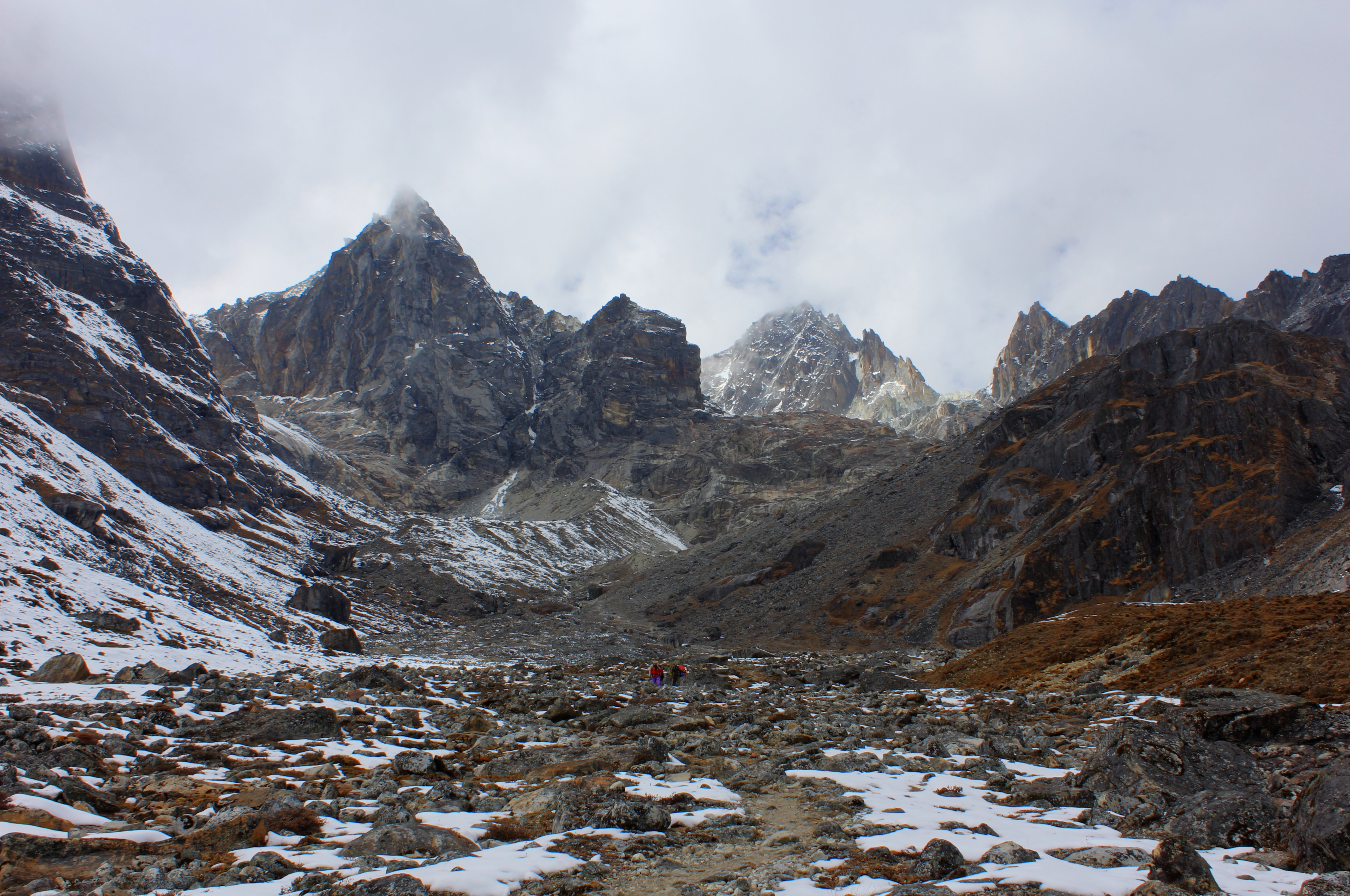
It was 1130hrs, the Prayer flags snapped in the wind and Choughs wheeled around us. The view down to the Nirekha glacier was as stunning as I thought it would be and there was no doubt that this was a great place to stop for lunch and soak up the atmosphere. It wasn’t all stunning views though! This was the first place we met “The Italian!” He seemed to be travelling with just one Nepali and a ton of camera equipment. That in itself was nothing remarkable, but he had this strange way of posing for the most ridiculous photos you could think of. Imagine a slightly drunk teenager showing off to a group of their friends or doing the most stupid selfies, then you’ve got an idea of what this guy in his early thirties was doing.
Our route took us over the glacier below the pass.
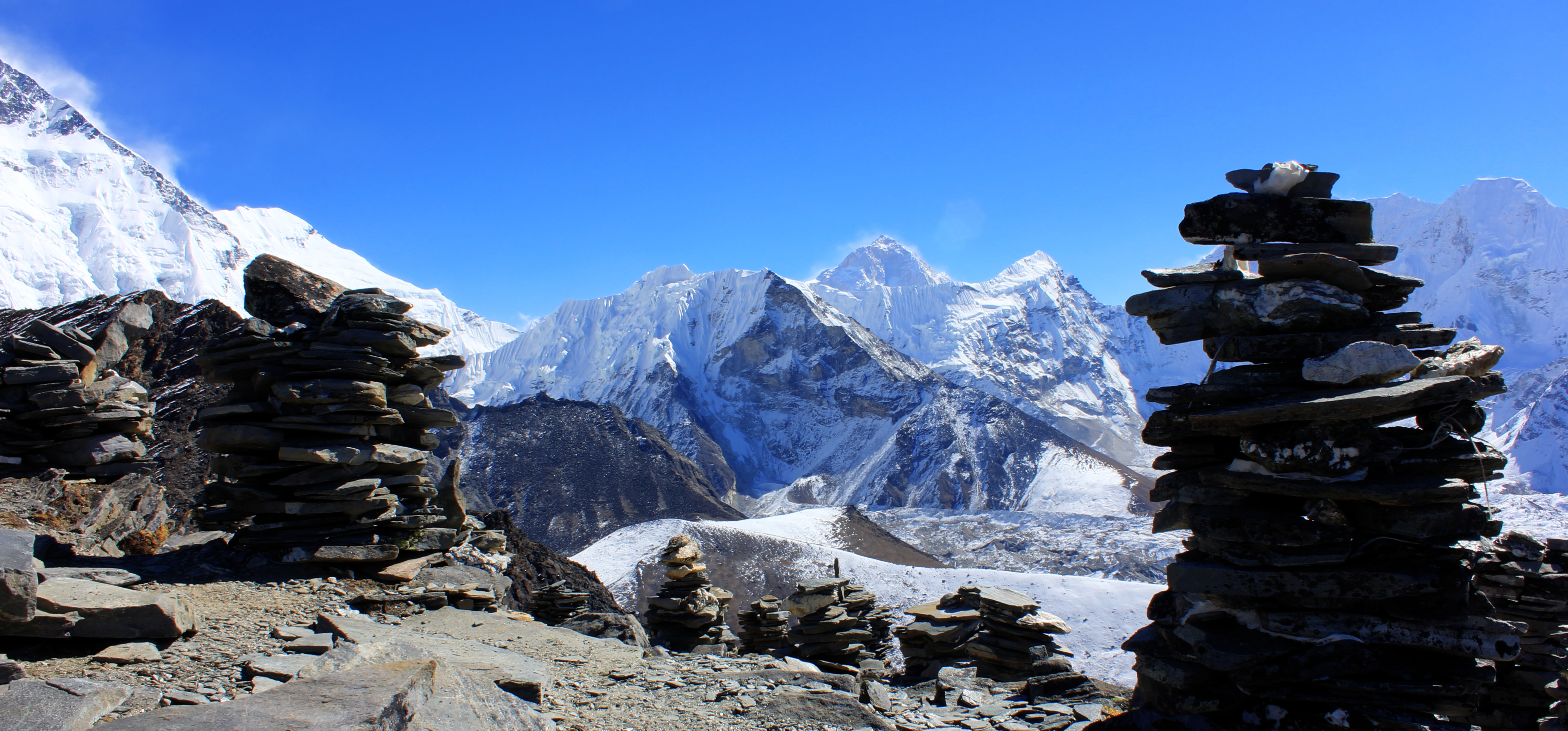
Prayer flags mark the pass.
Prayer flags and scarves left by grateful passers by.
We left the pass on a path that dropped steeply to a bergschrund, which had it’s own little lake. Pretty, but more than a little uncomfortable if you got it wrong and fell in. We contoured around it and onto the glacier proper, which we followed for about an hour. After the snout we moved onto the right flank of the valley and
Boudinage is the term for the blobby looking streaks of different coloured rocks.
followed the path to the top of a steep scrambly descent. The view back showed hanging seracs. There were also unusual “Boudinage” features in the rock faces, streaks of different coloured rock in lumpy sausage shapes, basically caused during volcanic activity by rocks melting inside other rocks as they were being laid down. But the views in the other direction were so absolutely fabulous it was difficult to concentrate on what was behind us. After the
The team reaching the edge of the snow just before the steep scramble down into the valley.
steep drop was a long post glacial meadow. Below that was the Chola Tsho (lake), bends in the river below that, Ama Dablam forming the background and the north face of Cholatse off to the right.
We took off our spikes and scrambled down, eventually reaching the snowy meadow and the final stretch to that night’s camp. A last old moraine hid the little village of Dzongla and we reached our tents 8¼ hours after we started. It had been a long and tiring day but worth all the effort.
The view down to the Chola Tsho (lake) with Ama Dablam coming out of the clouds.
Cholatse 6,335 metres on the right.
The view over the glacial meadow back toward the Cho La.
Friday 24th October
What a great night’s sleep, the best of the trip so far. It was a cold but sunny morning and the views of Cholatse were excellent. Breakfast was as good as ever, but a quiet had descended over the team. Helen had been feeling unwell for a while and Alex had taken her to one side to discuss her options. It was also Phil’s birthday, so there was a subtle tension between us all being fun and frolics for that, and being concerned about whether we would lose a team member.
The view of Cholatse from Dzonglha
Helen and Alex would go to Pheriche and get some medical advice, whilst the rest of us would go on to Lobuche with the hope that we would all meet up again later in the trip.
The track from our camp went downhill at first and then up a series of gently rising terraces. About an hour into the walk, Nuru came running up behind me, trying to catch up with Alex who was further ahead. There was a problem with Helen further back and I went to see if I could help. She was struggling with her breathing so Hugh and I shared her kit between us and escorted her at a super slow pace toward Pheriche.
One of the porters had been allocated to carry Helen’s main bag and it transpired he had “The Gift” for diagnosing and healing sick people. During a rest break we found him reading
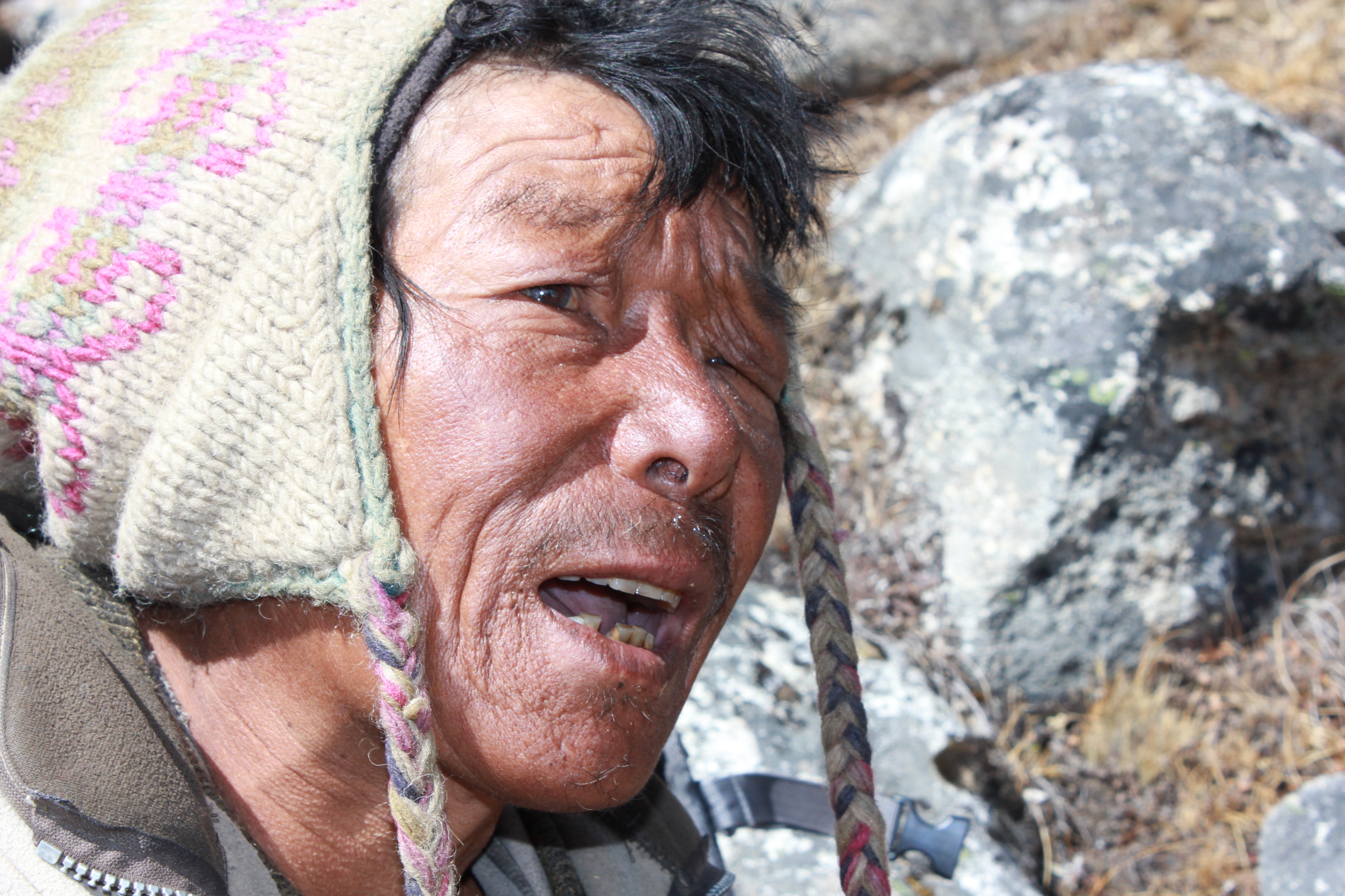
One of our porters exercising his “gift.”
Chris’s palm and he then proceeded to hold Helen’s hand and chant. He decided she had a bad case of “Khumbu Cough” and would recover in due course. He then said prayers over her, whilst gently striking her chest with his hat! For Helen’s part, she said she found the process quite relaxing and therapeutic in it’s own way. After two hours of walking, Phil and Chris took over and they accompanied Helen and Alex to Pheriche, whilst the rest of us went on to Lobuche.
They dropped out of our view and we continued on our separate path. Across the valley, we could see the more direct main path from Namche coming up toward us, which was as busy as a motorway compared to where we had been over the last week.
Pumori, 7,161 metres on the left of the skyline. Lingtren, 6,713 metres and Khumbutse, 6,639m to the right.
Lobuche was smaller than we had anticipated and people’s plans of grand showers and posh shopping were left in tatters. The tea house was okay though and we settled down to the first of many brews as we waited for Chris and Phil to catch us up. They burst in at 1710hrs and after many pats on the back, briefed us on Helen. She wasn’t able to go any higher and would slowly make her way back to Lukla with the Shaman and wait for us there. Alex would stay down with her in Pheriche for one night and meet us at Gorak Shep the following afternoon. We planned to spend two nights there and use tea houses as the cold was bitterly piercing whenever the sun wasn’t shining directly upon us.
We finished the night on a more pleasant note as the staff had cooked Phil a birthday cake. I say cooked rather than baked as it was all made using camping stoves rather than an oven. It certainly went down well and was really appreciated.
Saturday 25th October
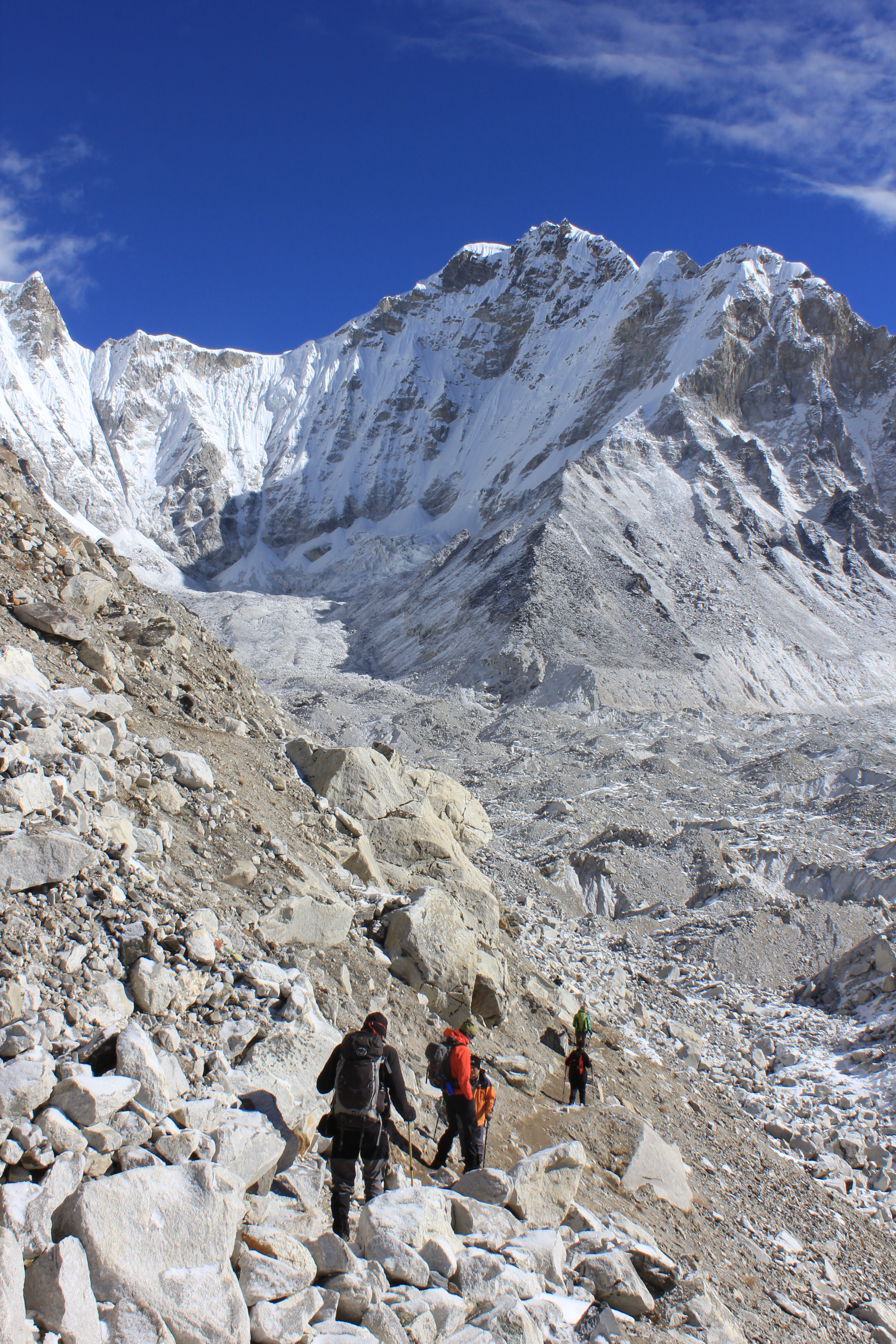
We set off from our campsite, down the hill and across the little dam over the village pond. Then almost straight away we moved into a little valley leading out of town alongside an old moraine. There were a lot more trekkers here as we were on the “motorway” to Everest Base Camp. The path winds in and out of the moraine and eventually gets steeper. There were a lot of yaks on the trail and it’s was narrow in places so they got very close to us. At one point, we were ascending a steep set of zig zags just as a yak train pulled ahead of us. At the very same time, a porter descending the trail jumped down from a rock step just in front of Lisa, which frightened the life out of her as she thought a yak was rolling down the hill on top of her.
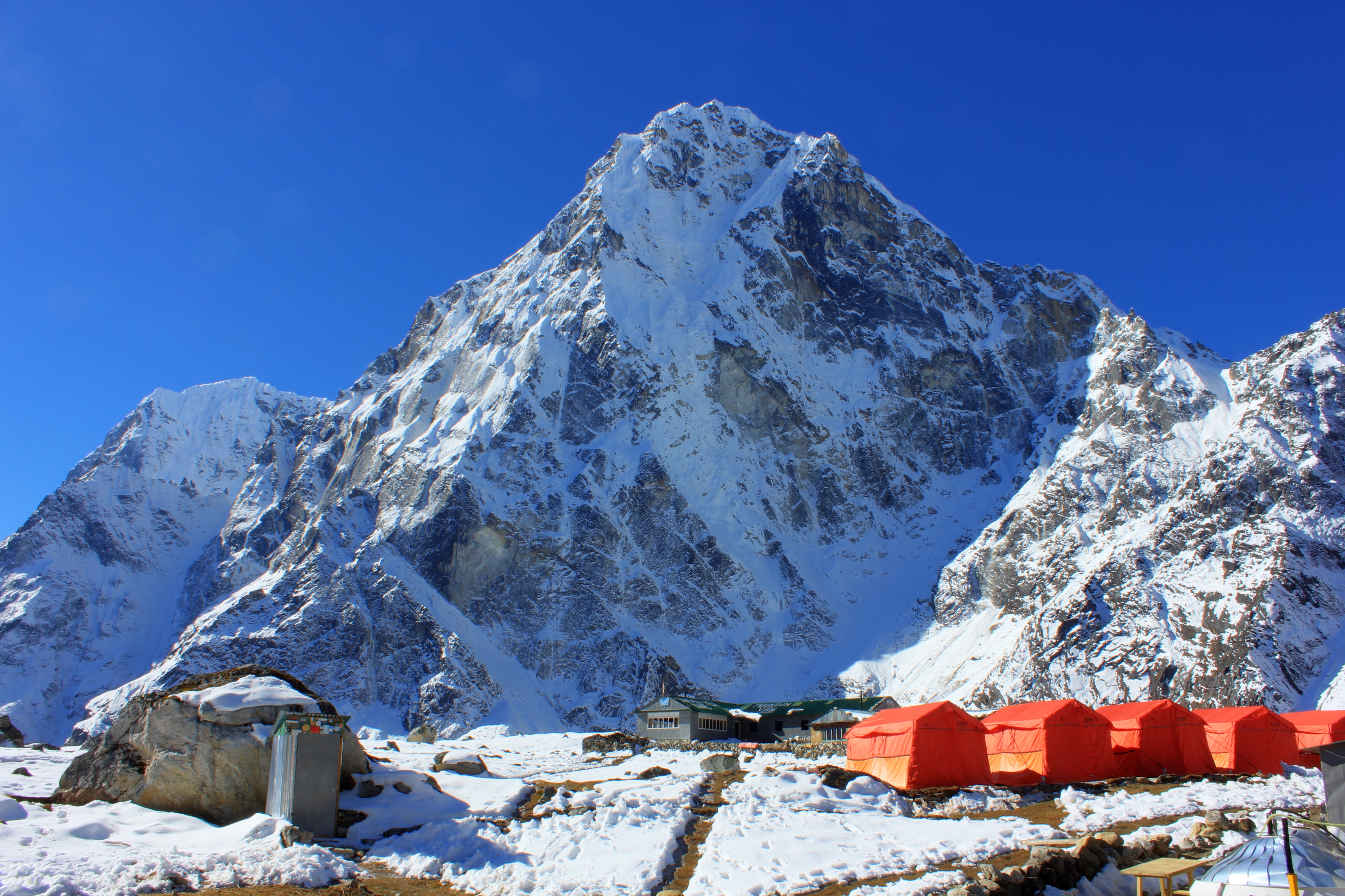
The path continued through piles of moraine debris and crossed a little side valley and medial moraine. The cross wind was freezing! Higher again, we started to get our first proper views of the Khumbu glacier. It’s huge, dirty with strewn rocks, complicated and impressive! By late morning we were walking through the snow and finally dropping down to The Yeti Resort tea house at Gorak Shep.
To our disappointment we found the rooms to be very cold. They were as plain as usual but with the addition of being semi-subterranean, with chunks of ice lying in the corridor outside. There was an unfortunate mix up over the prices of the rooms and as Alex wasn’t with us to explain, we got the wrong end of the stick and thought we had a really bad deal. Happily this was sorted out and although we weren’t too happy with the accommodation, we now knew we had been charged the going rate.
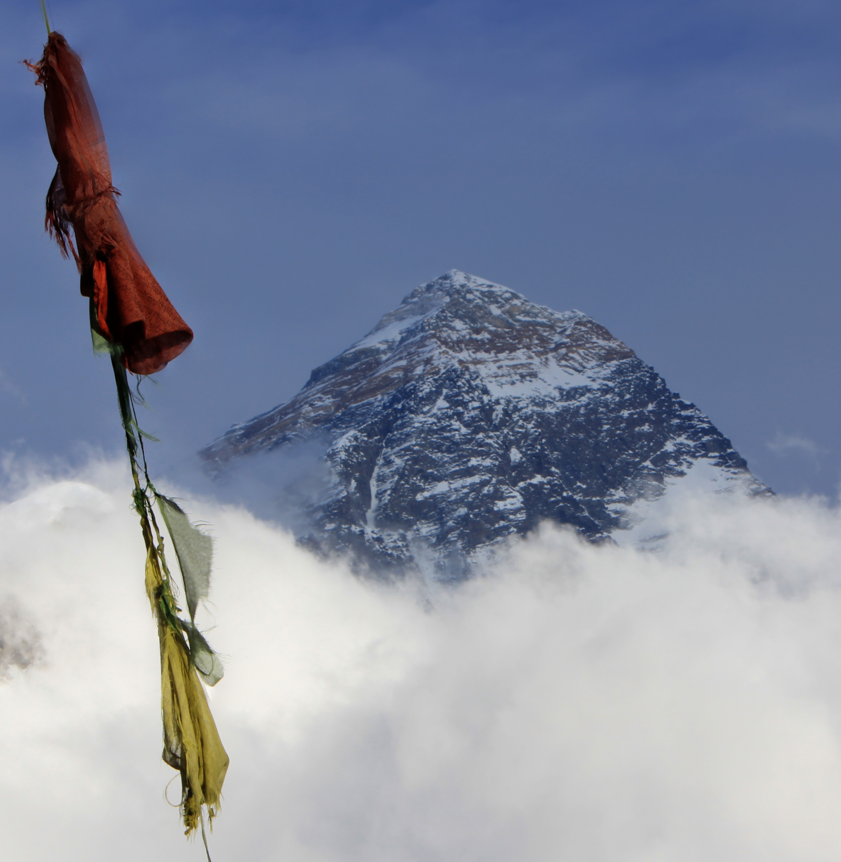
By the afternoon, Alex had re-joined us and at 1415hrs, Phil, Chris, Colin, Hugh, Alex and I started the journey up Kalar Pattar. It was super cold as we crossed the frozen meadow between town and the base of the climb. Low cloud hid all the surrounding peaks and even shrouded the lower slopes of our destination, so we didn’t anticipate any views. In fact, the outlook had been so glum that it had put off a few of the others from joining us.
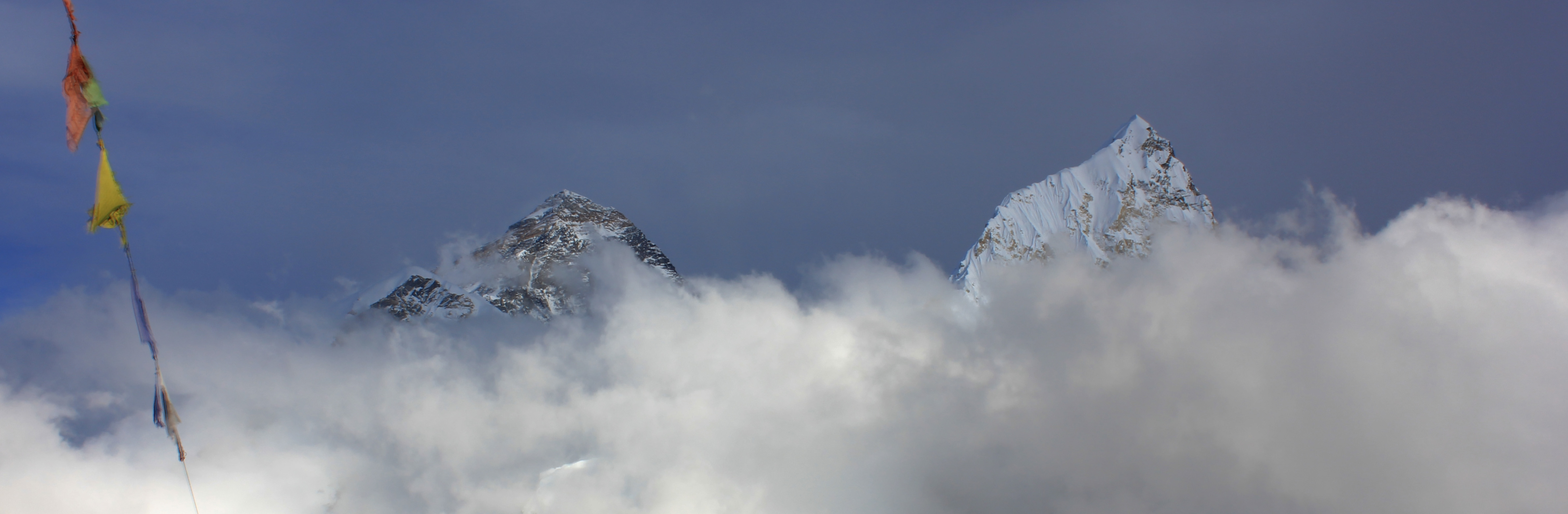
Everest, 8,848 metres and Lhotse, 8,516 metres as seen from Kala Patthar

Lhotse is the fourth highest peak in the world and is connected to Everest by the south col. It’s name is Tibetan and simply means “South Peak.”
After a few hundred metres I found myself taking the lead and although I was tired, I made a conscious decision to keep going at a steady pace and take no breaks until I reached the top. Out of the cloud, we got glimpses of false summits and a subsidiary peak off to our left. Tantalisingly, every now and again, we got views of Everest summit and Lhotse peeping through the cloud. Finally, ahead of us, I could see prayer flags in the distance. The wind had blasted the snow into sheets of ice and the micro spikes would have been really useful on our feet rather than back in our rooms.
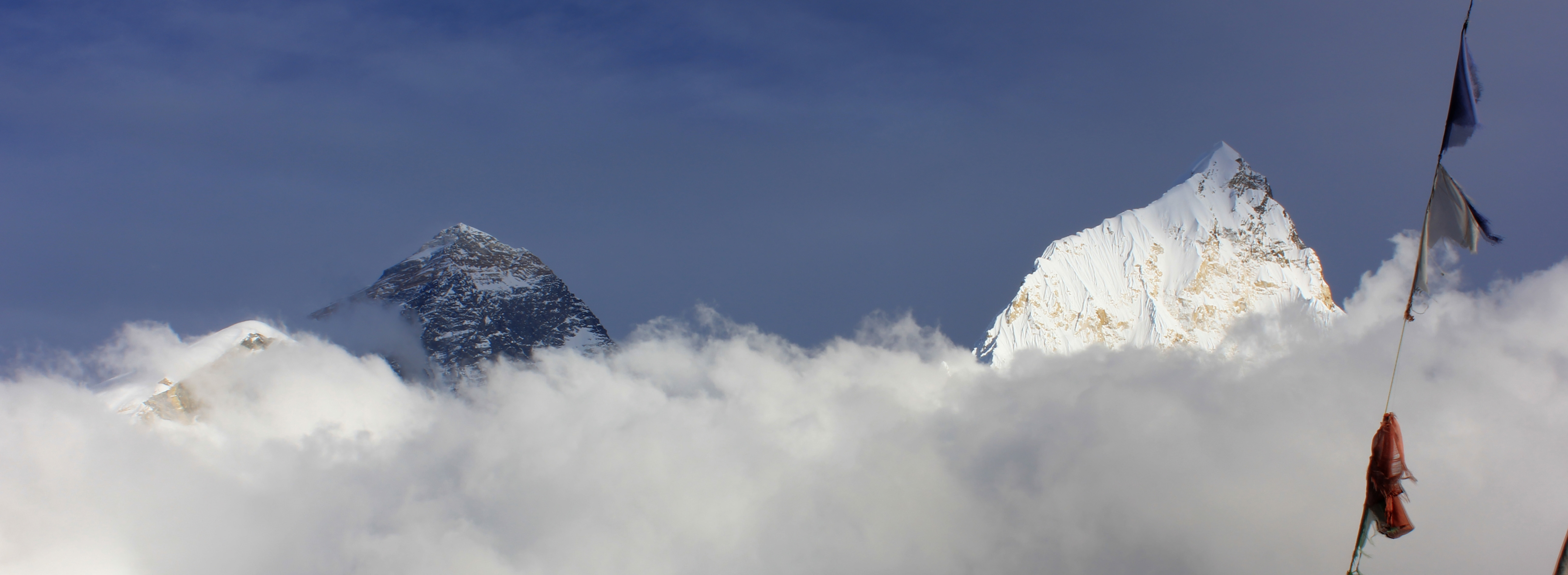
The walk up had been shrouded with cloud and we doubted we would get this fantastic view.
At the flags, there was a small snowy platform and above it a pinnacle of rock with a 45°slope that formed the final summit. I scrambled up it, mindful of the huge drop off to my left. By now, the views to Pumori were stupendous, with Everest and Lhotse dropping in and out of view by a rate of knots. The others joined me at the top and all thoughts of fatigue and cold left us as a state of euphoria swept us. We weren’t quite at the top of the world, but we were certainly close enough to see it!
The south summit is the shoulder on the right.
More uplifting views!
After many photos, we reluctantly put our cameras away and began the journey down. As ever, the cold seeped deep into our bones, but we still enjoyed the hour long plod down back to the village for tea and medals.
Sunday 26th October
No bed tea was getting handed out today, just a quick 0630hrs breakfast and by 0715hrs we were out of the door. It was freezing. Bloody freezing! Although the sun was up, it wasn’t yet shining directly onto us and it was still minus 16° C. It felt colder.
Following the trail to Everest Base Camp
Our route took us along a muddy meadow alongside the Khumbu moraine. It then climbed onto the moraine and threaded it’s way always higher through the rocks. Lisa was struggling with the cold and began to breathe heavily. After a short break, she settled down again and we continued on. We reached the sun at 0835hrs and things got much easier after that.
Across the glacier, the slopes climbed steeply to peaks that were still hidden in the clouds. A long and ominous rumble drew our attention to an avalanche falling down a distant couloir. It must have been big from the noise it made, but when we saw it, it looked tiny against the huge slopes it was falling down.
The path ahead of us contoured down underneath a crumbling morass of scree and boulders, and we kept 10 metres apart again to avoid bunching in the danger area. As I reached the end of the dodgy section, a small release of stone fall just behind us reminded me of the precarious place we were in.
The summit just visible over it’s western shoulder.
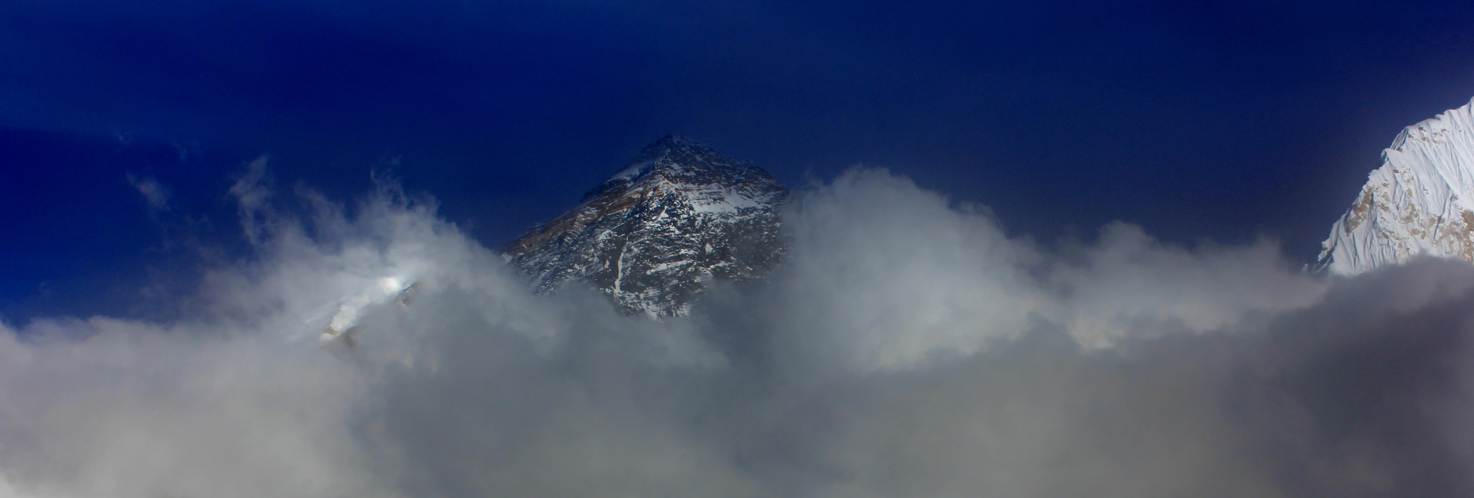
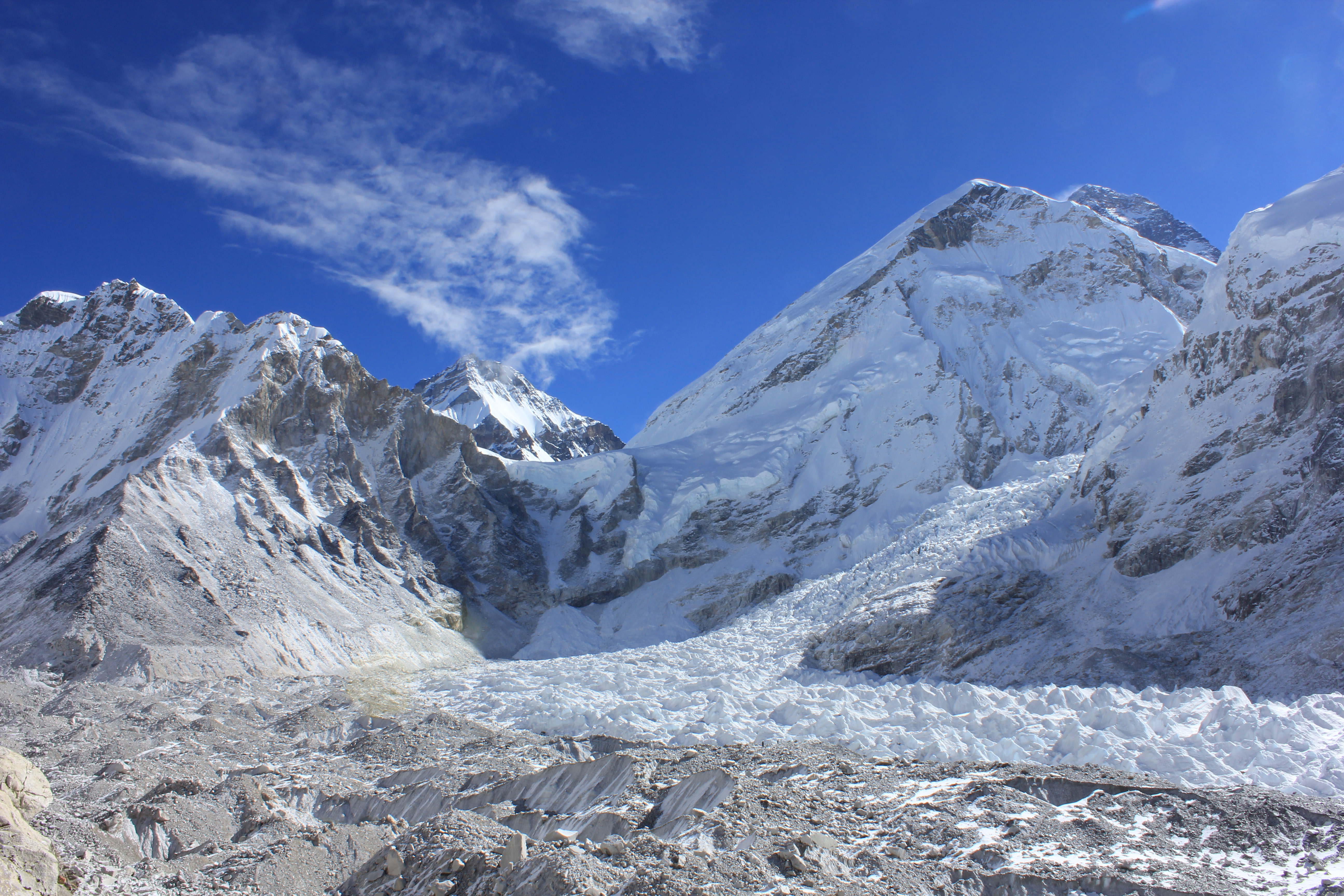
The path doubled back on itself and moved onto the glacier proper. Huge boulders and thick snow were scattered across the path, which threaded around ice pools, seracs and precariously perched rocks. The path did one more “U” turn and there we were, Everest Base Camp. Flags, painted rocks and signs announced our arrival. The Khumbu ice fall was just a few hundred metres away, and peeping over it’s own shoulder was the summit ridge of Everest.
Apart from our group, there were just three other people there, so the early start had been worth it. We soaked up the views, took loads of photos and even had a “wee nip” from Chris’s hip flask. Not far from us another avalanche released, but it just seemed dwarfed by the huge faces around us.
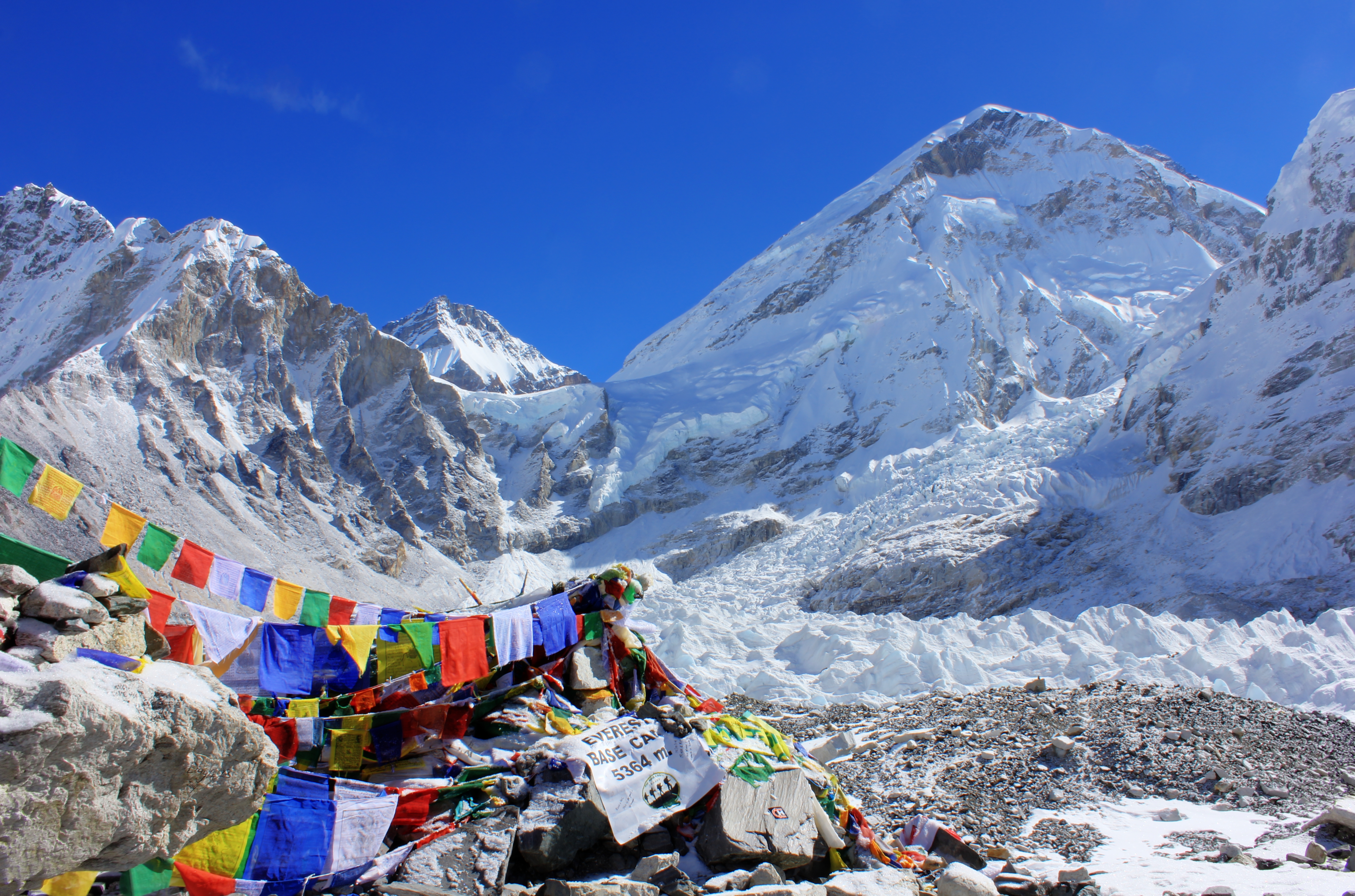
Prayer flags marking the otherwise empty campsite
Further back down the valley, we could see antlike figures trekking along the moraine and we knew it wouldn’t be too long until we had to share the campsite. It was time to go so they could also get the place to themselves.
Our team making their way back down the moraine toward Gorak Shep.
We passed under the dangerous ground again, which by now had received more sun and there were numerous trickles of stone fall as we moved along, and another avalanche thundered down a gully toward the opposite side of the glacier. Awesome and deadly.
We were back at Gorak Shep by 1215hrs and after a quick lunch, back on the road and in Lobuche by 1415hrs. It seemed that so much had happened that I had to remind myself I had only left there the day before. It had been a great day out, and for many, the highlight of their expedition.
Monday 27th October
Our original plan had been to stay in Gorak Shep two nights, and as we had come down a day early, we elected to spend the whole of the day as an admin and rest day.
We sat in the tea house and were amazed to see some home dentistry going on outside. One of the girls who worked there was obviously having trouble with a tooth, and several of her colleagues took turns in trying to yank it out of her head with different sets of pliers! None of them were successful and she blithely got back to work as if none of this had happened. Tough people!
That night we had another “Yak Attack.” This time, none of the tents were bashed into, but apparently the constant clanking of yak bells was enough to get Chris and Hugh out of their tents demanding that the porters help them shift the beasts so they could get some sleep!
Tuesday 28th October
Alex, Chris, Colin and Phil crossed the Kongma La, whilst the rest of us descended to Dyngboche. This last pass is considered by many to be the toughest of the three on our trip, and the locals tend not to use it as it’s easier to descend to Dyngboche then go north up to Chukkung rather than over the top via the pass. Lisa had opted not to go to Chukkung and I planned to accompany her to Dyngboche and then make my way to Chukkung to meet Alex and the rest of her crew for the last peak of the trip.
They left at 0715hrs and we left an hour later, after the sun had reached our route. We followed the stream south out of Lobuche until the path climbed onto the old moraine and moved toward the confluence with the cutely named Chola Khola. The lower we got, the greener the scenery got. We could now see around the shoulder of Awi Peak and get a view all the way back up to where we had previously stood when we had come off the glacier after crossing the Cho La. In the other direction was Pheriche, sitting in it’s green meadows and walled enclosures.
Our path crossed the Thukla La over a short spur, along which are numerous monuments built to remember those
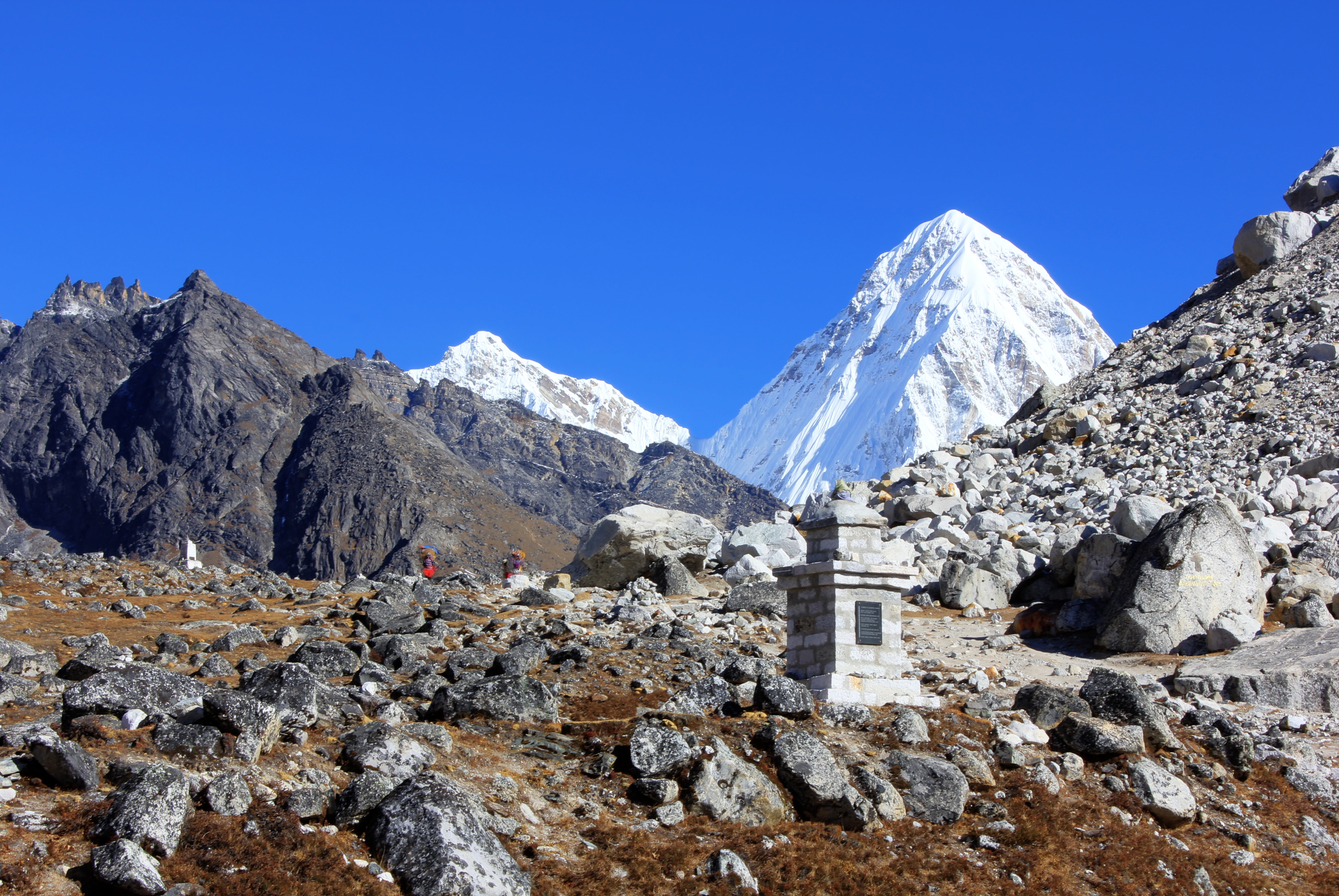
scores of memorials dot the slopes of the La, with Pumori in the background.
that have died on Everest and other mountains of the region. They aren’t graves, as many of the dead will have been left where they fell, either by choice or because the survivors could not find them or spare the energy to recover them. Asians, Europeans, Americans. Anatoli Boukreev, Scott Fischer and other names I didn’t know. Lots of people. Chortens, Stupas, plaques, prayer flags and beautiful views in every direction. Not a bad place for a memorial, but chilling when you saw just how many there actually were. For me it was a sobering reminder that mountains are neither good nor bad. They just “are.” If it goes wrong, it can go horribly wrong and the huge forces of nature will overwhelm a human in an instant. An avalanche won’t know if you’re an expert or a novice, but it can fall on you all the same.
Prayer flags near the memorials.
We dropped well below the snow line and reached the little village of Thukla. As we took a quick break we chatted to a Canadian couple who were well stocked with their own supply of homemade jerky they’d brought with them. It would have tasted good wherever you ate it, but boy! It tasted great sitting in Thukla.
Below the village, the Khumbu stopped being a glacial stream and became a proper river. We crossed the bridge out of town and contoured along the hillside, taking the path above Pheriche. We were now moving along an ancient moraine that was old enough to be completely solid and meadow like, with just the occasional erratic boulder showing through. Bypassing Pheriche, hundreds of metres below us, we met a group of Welsh soldiers who were on their way to Kala Patthar and Everest Base Camp as a warm up before ascending Island Peak.
A really pretty “Heidi” style hafod made a great foreground to the views of Ama Dablam and then we made a final climb onto an old medial moraine crossing our path and hiding Dyngboche from our view. The top of the moraine was crowned with chortens, flags and a stupa. The view down onto Dyngboche was great, but it paled by comparison with the view up the valley to the north east. Nuptse, Lhotse, Lhotse Shar, Island Peak, Makalu and Ama Dablam all in the same view. Breathtaking!
We dropped down into the village in a real holiday mood. No icy subterranean rooms here. The place was full of bakeries, shops, a snooker hall, sunshine, grass and the only snow was above us on the mountains. The tea house was palatial compared to where we had been staying. It had a sunny terrace outside, clean carpeted rooms and a real bathroom with a floor and a fitted window. We were back in civilisation!
Of course, for me, this was just a fleeting visit and it was quite a mental torture to drag myself out of there after lunch and continue up the valley to meet the others. I had another walk of an hour and forty minutes or so to get to Chukkung and find Alex and her team. It was quite tough to walk out of the lovely tea house where the others were making plans for their bakery trip, whilst I would be heading back into the bleak land of cold, thin air and ice.
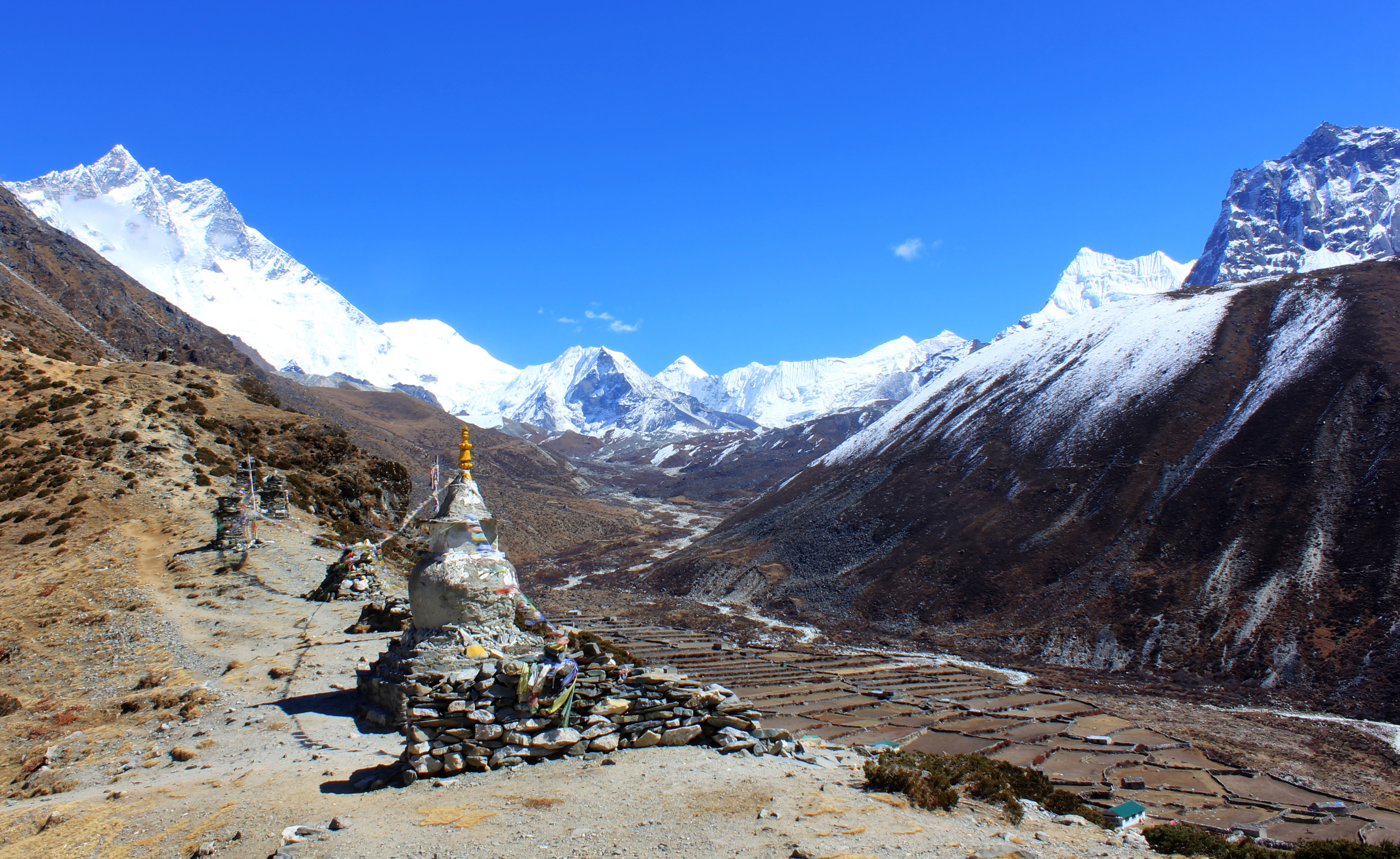
Chortens and Stupas above Dingboche. Island Peak, 6,183 metres sits in the bowl at the head of the valley.
Dawa and I took the path that threaded it’s way out of town through narrow passages in the thorny scrub. Luckily the yaks were going in the same direction as us as there was little room to step aside for anything. Higher up, the yaks trotted safely off the path and into a walled meadow, but revealed a group of untethered yaks ahead of us with no yak driver. Dawa picked up some stones and we both shouted at them, me mimicking the driver’s cry of “La” which caused them to trot away from us. In fairness I think it was Dawa that shifted them, but I like to think I played my part!
Higher again the scrub ran out and we crossed an old boulder field that was criss-crossed by glacial streams. There were a few trekking groups coming toward us, but very few going our way. We crested a rise and saw the rooves of Chukkung ahead of us. At a little hafod we passed our porters and at 1440hrs we hit the town. Dawa led me up to the tea house and to our surprise we saw the others sitting in the Namaste tea house. They’d beaten us there by around 30 minutes and were well into their second or third cuppa as we joined them.
Chris and Alex elected to continue camping whilst the rest of us opted for rooms in the hut. It looked like I’d be telling another “Yak Attack” story when the oddest yak strolled into the field near to Chris’s tent. It was all black except for a patch of white over half it’s face which gave it more than a passing resemblance to Jason from the horror films. To add to the mystique, as soon as it got to the centre of the field it just stood there motionless as the mist swirled around it, staring at the tea house waiting for it’s moment to pounce. I bet he’s still there now, Jason the Killer Yak!
Wednesday 29th October
Although bed tea was at 0545hrs, we didn’t start up our final peak, Chukkung Ri until 0715hrs. The sun was already up, but it was still freezing cold, with lots of ice in the streams we passed. As we left town, the path climbed up at a 45° angle across sandy soil. The views of Island Peak, Lhotse, Makalu and the entrance to the Amphu Lhapsa were clearly visible and in the crystal clear air, they looked as if they were just a few hundred metres away.
The path curved around and into a bowl on the side of the mountain and we could see it rising ahead toward a
Cairns decorating the col just below the summit of Chukkung Ri,
heavily cairned col. Although it was never particularly steep, it climbed relentlessly. As we reached the col, we walked into a stream of wind that scoured up from the other side over snow, hitting us with it’s icy cold. It was an easy romp up the final few hundred metres where we revelled in the views all around us. Cho Oyu, Pumori, Nuptse and all the peaks right around to Ama Dablam. Also on the top was “The Italian” continuing with his over the top poses and selfies, completely oblivious to the mirth he was causing.
The clouds began to roll up the valley from the south and snow plumes were being whipped off the higher peaks. It was lovely here now, but might not stay that way. We descended at a rate of knots and were back at the lodge just 3 and a half hours after we’d left. Not bad going seeing as the guide book time was given as 3hours up, and two more down.
A view to Island Peak from Chukkung Ri.

Our team on the south west summit
Lunch was taken sitting in the sun outside the tea house and at 1200hrs we were ready to start our descent to that evening’s campsite. It only took an hour before I was walking back through Dyngboche and then another two hours until we got to Pangboche.
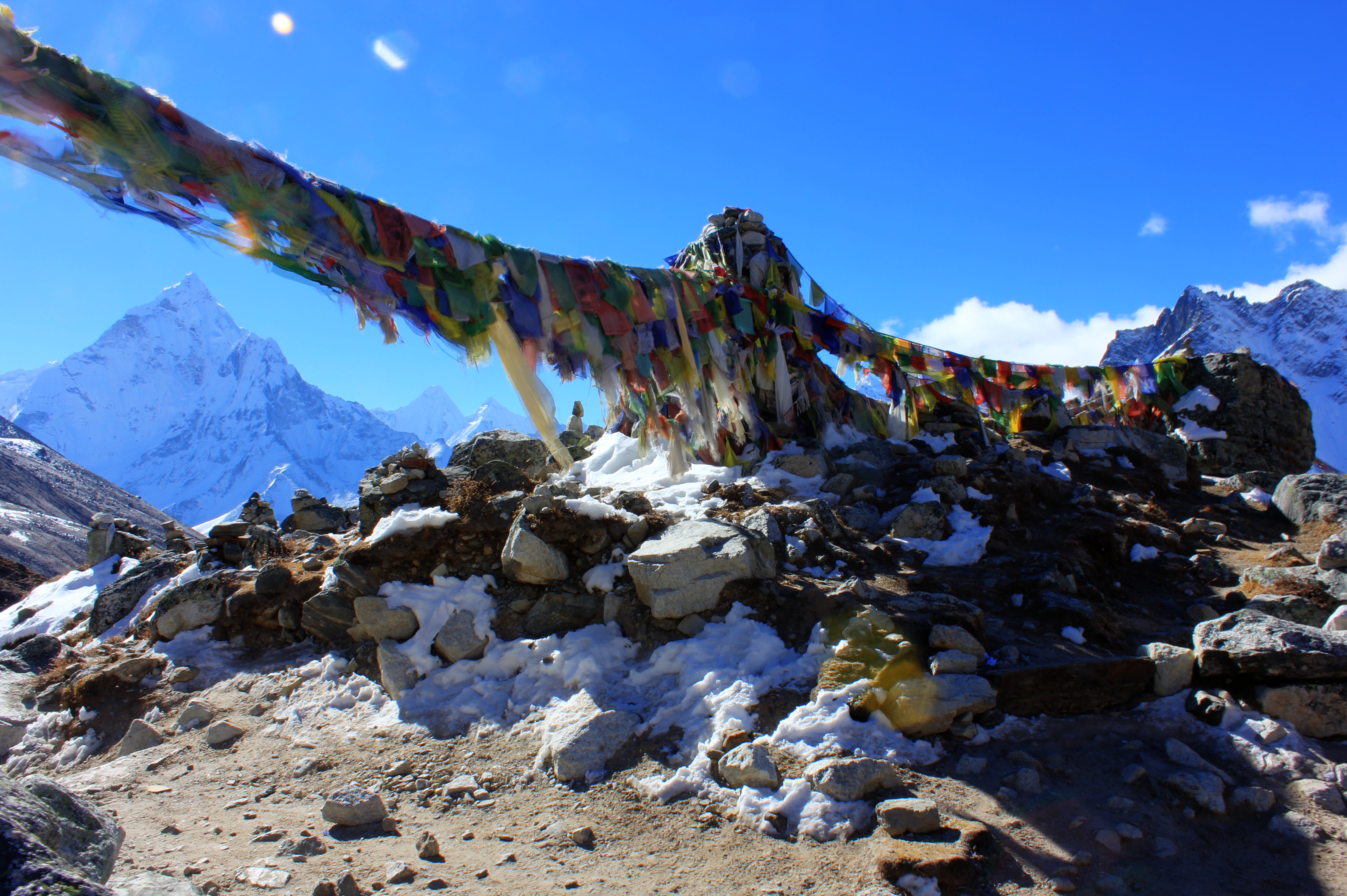
A stupa surrounded by Darchor flags.
The last 40 minutes were along a really beautiful part of the trail, but I was tired and spent more time looking at the floor than around me. It was a welcome relief to walk into our camp at the Gomba tea lodge, right next to the monastery at Upper Pangboche, where the rest of the team were waiting to greet us.
Thursday 30th October
Leaving our camp at 0815hrs, we immediately turned left so as to pass the monastery on the proper side and turn the many prayer wheels along the monastery walls. Inside the monastery, which the others had visited
Stupas, Mani stones, chortens and carved boulders dominated the path in every direction.
the day before, is a glass case said to contain the partially mummified skull of a Yeti. Sadly for me, the monastery wasn’t yet open for visitors so I’ve yet to see any real Yeti parts in the flesh.
The path led out of town and gently down the valley passing scores of chortens, stupas, mani walls and inscribed rocks. There were so many that it was sometimes difficult to know if you were expected to go around it to it’s left or whether it could justifiably be seen as off your path. The path contoured along the side of the hill above a steep drop, and the Dudh Koshi was visible far below, boiling through the rocks in the river bed. On the middle horizon was Thangboche monastery, sitting on it’s distant ridge.

Finally we were able to see Nupla again, a view which had dominated the valley above Namche Bazaar.
As Lisa and I walked around a corner on the path, a Nepali riding a white pony came charging in the opposite direction so that we had to almost jump out of his way. He looked completely at ease bounding along the twisting path with the huge drop just at his elbow.
The way began to steepen and we dropped toward the river. By now there were a lot of people coming in the opposite direction and we could see we had been at altitude for much longer as they seemed to gasp for breath with each step higher up the mountain they took. We crossed the river with superb views to Ama Dablam behind us, and began the long ascent to Thangboche monastery. The path led through rhododendron stands and pine trees shrouded in “Old Man’s Beard.” The sun dappled through and picked out more mani stones along the path. Finally, we crested the ridge and arrived at the monastery. As ever, the views were brilliant in every direction. After a short break we dropped of the ridge as the path continued on it’s way down a steep set of switchbacks that seemed to go on for ever. The mental torture was that we all knew that for every step down we descended, we would have to climb back up the other side before we reached Namche Bazaar.
We crossed the river at a suspension bridge and began the long slog back up. Not far from the top of the slope, we stopped at the little hamlet of Tashinga where we had lunch. High up above us eagles soared on thermals as they scanned the slopes for their next meal. Coming down the path next to us were a few horses and the white pony up front looked distinctly wobbly on it’s legs. Our earlier speedy rider wouldn’t have looked so sure had he been on this steed.
The seemingly endless path leading to Namche Bazaar.
The last few hundred metres up saw us crest the second ridge and from there the path contoured across the side of the mountain, gradually climbing toward Namche Bazaar. We passed through a number of small hamlets, surrounded by Himalayan Red Birch trees. Cloud had now settled down around us and it looked as if it could rain at any moment. Still the path wound it’s way across the mountainside, disappearing around spurs on the hill and reappearing in the distance. Eventually we turned a corner and there it was, Namche Bazaar. Our tea house was right at the end of the path as it reached town and at 1500hrs we finally closed the great circle on our trek.
Getting closer to Namche Bazaar.
We stayed at Danfe lodge again, but this time instead of camping, Lisa and I got a room. Across the corridor from us was Helen, who had slowly been making her way down to an altitude that wouldn’t adversely affect her breathing. It was great to see her again and she was in much better spirits than when we’d last seen her.
As we lay in bed that night, the sound of dogs barking at goodness knows what echoed across the town. The scurrying noises from inside the plywood wall cavity reached a crescendo just before dawn and whatever was in there would have been a lot less welcome if it had got into the room. After that, we only had to contend with Nepal’s loudest yak herder as he decided to take his charges for an early morning stroll. Those things apart, we had a great night’s sleep!
Friday 31st October
The day started easily with a short shopping session in Namche Bazaar, after which we started the journey back past places we would know. At first, the landmarks came quickly, the Police Checkpoint and then the toilet block at the Everest View Point. As on the way up, there was no view of Everest to be seen and claggy cloud hung in the valley hiding the mountain from our view.
Because it was a Friday, scores of porters with oversized loads and long mule trains were pushing their way to
Big loads being carried to Namche Bazaar for market day.
Namche. Saturday is market day there and these were the goods that would be going on sale. Quite a few times we had to wait whilst long strings of pack animals and trekkers came the other way on the narrow paths. There wasn’t enough room for two way traffic so we had to wait for the right gap before dashing down to the next waiting spot. It was also a day of bridges. By the time we got to Phakding we would cross 1 concrete bridge, 2 wooden bridges, 5 metal bridges and 5 suspension bridges! That didn’t include a few sections of shored up pathway where it was crumbling away from the hillside rather than crossing a river or stream.
Mules carrying loads over the suspension bridge south of Namche Bazaar.
Because we had elected not to stop for lunch, the day seemed to be longer than usual and now the landmarks were more spaced out than I thought they would be. On the plus side, the weather was mild and clear lower down so the views were much better than we had got on the way up when it had been raining. We got into Phakding at 1415hrs and my Everest beer practically evaporated on my tongue as I rested my tired feet.
Saturday 1st November
Another relaxed start heralded the beginning of our last day walking. At 0810hrs we left the Everest Guest House on the path to Lukla. It was gentle enough to start with but had steep sections that would take us up the 200metre altitude gain we had to reach Lukla.
Lianne and I were walking together when we spied a group of young boys playing at the side of the path ahead of us. As we drew level with them, one of them stepped into our path and presented us each with a little sprig of wild flowers. No sooner had we accepted than he politely requested that we pay him in chocolate! Lianne handed over 10 small sweets and after they had divided them between the four of them, they politely handed back the two spare sweets as surplus to requirements. I think the kids in the UK who go “Trick or Treating” could do with learning some good manners from these guys!

One of the places we passed through in both directions.
Further on, I could see the Zatrwa La on the horizon, which gave me an idea where roughly Lukla would be on the mountainside ahead. Numerous helicopters dropped out of sight over the ridge ahead of us, so this confirmed the location of the airport. But in my mind, I was sure there was one last side valley we had to cross and we would have to drop down a few hundred metres and then climb back up the other side to get to Lukla. It didn’t seem to make sense and I couldn’t work out where the side valley must be.
We reached a well paved section of track and climbed it to the top of a slope. Lo and behold, there was the gate into Lukla. My memory had been playing tricks on me and the side valley I had anticipated seeing was a few days back up the trail between Namche Bazaar and Thame. We strode through town buoyed up and euphoric, and practically jogged up the last few metres of steps that took us back into the Tara Lodge.
My trek had involved around 105hrs on the trail with just one rest day in three weeks, I had summited three 5,000+m peaks and crossed two 5,000+ passes. I was rewarded with some of the most stunning mountain scenery the planet has to offer and was fed at least three years’ worth of garlic to help me do it all. Another great trip!
